Saturday, November 29, 2014

West Bali National Park

Overview

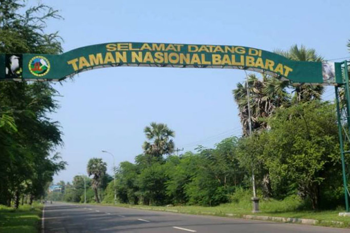
West Bali National Park (Taman Nasional Bali Barat in Bahasa Indonesia) is the most north-westerly point of Bali. It includes the whole of the Prapat Agung Peninsula, and large swathes of land around the towns of Gilimanuk, Cekik and Banyuwedang. The official area inside the park boundaries is 190 square kilometres, with a further 580 square kilometres of protected reserve in the highlands to the east. In total this accounts for some ten percent of Bali's total land area.

History

The park was first officially recognised as an area of importance in 1917 when the council of Bali rulers designated it as a nature park. It was fully established as an Indonesian National Park in 1941.


Landscape

The habitat is very varied with rainforest, dry savanna, acacia scrub and lowland forests, as well as more montane forests in the higher centre. There are also some pockets of dense mangrove forest.
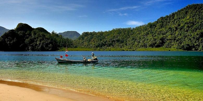
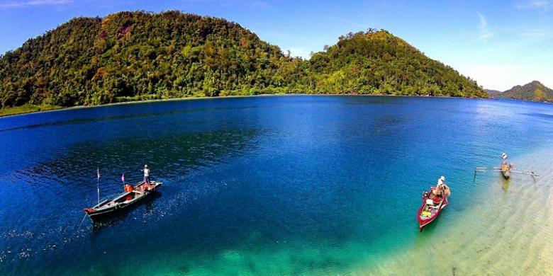
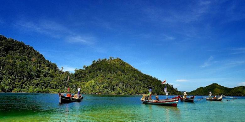
In the north of the park there is an obvious north jutting peninsula called Prapat Agung. Around this peninsula there are long stretches of protected beach and offshore coral reef as well, as a small offshore island called Menjangan. The latter is a very popular diving destination.
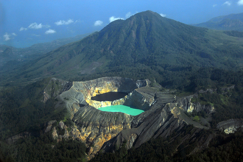
There are several long extinct volcanoes in the protected reserve area to the east, with Mount Patas (1,412 metres) and Mount Merbuk (1,388 metres) being the highest points. These peaks are dominant visual landscape features from within every area of the park.


Flora and fauna

Bali Starling
One hundred and sixty species of bird have been recorded in the park, including the near extinct Bali Starling, Bali's only endemic vertebrate species, and a key reason why this national park was created in the first place. By 2001, as few as six individuals were thought to survive in the wild, all of them in this park. Since then captive breeding and re-introduction efforts have continued apace, but poaching pressures are a large problem. With that in mind, a seconf re-introduction programme was started in remote regions of Nusa Penida in 2004. Keen birdwatchers can find a checklist of likely species and their status here .
Mammals found inside the park include Banteng, a species of wild cattle from which the familiar Bali cows are descended. Java Rusa and Indian Muntjac deer are quite widespread, and Menjangan Island is in fact named after these (Menjangan means deer in Bahasa Indonesia). Wild Boar and Leopard Cats are both quite common but seldom encoutered.
A Bali Tiger (a full sub-species of Tiger) was shot here in 1937, and despite rumours to the contrary, that is the last ever confirmed sighting of an animal considered extinct since that moment.

Climate

Not noticeably different from the rest of Bali or eastern Java, but it may feel a little hotter and drier in the dry season here than in southern parts of Bali.
Bali is always warm, humid and tropical, remaining around 30-35°C (85-95°F) all year round. The April-October dry season and November-March rainy seasons are only relative, with plenty of rainfall around the year, but the Balinese winter is cloudier, more humid and with a higher chance of thunderstorms.
Bali Barat National Park Office HQ, Jl Raya Cekik-Gilimanuk, Jembrana, Bali 82253, ☎ +62 365 61060 (tnbb@telkom.net, fax: +62 365 61479), [2]. 7:30AM-5PM.  edit
Bali Barat National Park Vistor's Centre, Labuhan Lalang,

Get in

Most visitors to the park arrive along the north coast road from Lovina (about 90 minutes) or Pemuteran (about 15 minutes). Others come from the south via Gilimanuk (about 15 minutes)
All visitors should check in at one of the two park offices (PHPA) for information, and to purchase permits and arrange guides. The headquarters is at the village of Cekik just south of the Gilimanuk in the west. The other is at Labuan Lalang on the north coast from where boats to Menjangan Island depart. The main ranger station is on the road between the two offices at Sumber Klampok.
The park staff are welcoming, helpful and will arrange guided tours for you. Most hotels in the area arrange guided tours, but if you want a more customized experience it is advisable to directly talk to the guides at the partk offices.
For example, Putu Arta in the Labuan Lalang office (+62 813 38399576) is an experienced and enthusiastic guide, who is happy to share his extensive knowledge of the flora and fauna of West Bali National Park with you.


Fees/Permits

Permits and obligatory guides are available at the park headquarters at Cekik and the office at Labuhan Lalang. The official permit charge is Rp 25,000 per person. The cost of a guide is negotiable. Use your common sense and do not be tight. Fees for the official guides have become fixed. at one office at 350,000 rupiah for a two hour hike. Official guides, however, will demand the official price (for foreigners) of 200,000 per person for a 3 hour hike (2013 rate). As of 15 July 2014 entry fees increased to Rp 200,000 for foreigners with additional surcharges depending on activity.
Get around

Only a small percentage of the total area of the park is open to visitors, and this rule must be respected. There are two key ways to explore the park: either hiking the trails or concentrating on marine aspects.
Walking the trails must be done with an official guide from one of the national park offices (most normally the one at Cekik). Boat trips to Menjangan and around Gilimanuk Bay can be organised in advance (ask at your hotel), or by charter on the day you arrive.
Persons expecting to wander through a tropical rain forest might be very disappointed with the hikes, as the trees are mostly deciduous, with a rather open ground cover.
See and do

The official park trails should be explored with a guide recommended by the national park ofice. This is actually a rule but it is sometimes 'quietly' ignored. Please do not do this nor encourage the practice, despite the very irresponsible advice given in some printed travel guides to do so.
The Tegal Blunder Trail is most popular with birdwatchers, and it is an easy two hour walk. The ranger checkpoint is at the village of Slumber Klampok about 20 minutes west of Cekik. From the same checkpoint you can take the more strenuous Gunung Klatakan Trail to the south east. This is tougher walking for about five hours, but it takes you through some memorable rainforest. There are other trails and opportunities for interesting hikes, but these are the two most popular and the easiest. Ask guides about other opportunities at the time, particularly those involving hiking deeper into the Prapat Agung Peninsula.
The uninhabited Menjangan Island is a must-do for any visitor to Bali interested in marine life, snorkelling or diving. Boats leave from the beach at Labuan Lalang at the northern edge of Teluk Terima bay, and can chartered on the day. Groups of tourists often club together at Labuan Lalang in the mornings for that very purpose. Any boat charter must be accompanied by a guide, and you must purchase a permit (Rp 25,000 per person) from the national park office in the main Labuhan Lalang car park. Many of Bali's dive operators based in the southern tourist regions offer dive excursions specifically to Menjangan. The snorkelling here is probably the best on Bali with good clear water and calm seas.
There is a notable temple on Menjangan called Puri Gili Kencana which is certainly worth a visit. You can walk around the whole of Menjangan in about 1 hour and 15 minutes. If you take it slower though there is plenty of natural coastal beauty to absorb.
Gilimanuk Bay snakes into the south western tip of the Prapat Agung peninsula, and the park office can arrange a guided boat trip for you in a traditional outrigger. Expect to pay about Rp 300,000 per hour including guide fees. The bay is quiet and supports a rich diverstity of marine life. There are some notable areas of mangrove forest fringing the bay, and these act as a natural nursery for the diverse fish life in the area.


Lodging

There is one official high end resort inside the boundaries of the national park on the Prapat Agung peninsula. There is no other accommodation inside the park. Visitors on a lower budget day trip the park from Gilimanuk, Pemuteran or Lovina where there are ranges of accommodation to suit all budgets.
There is popular budget accommodation about two km north of the Cekik park headquarters office on the road to Gilimanuk called Pondok Wisata Lestari, tel: +62 365 61504.

The Menjangan, ☎ +62 362 94700 (bliss@themenjangan.com). Member of Lifestyle Retreats, West Bali National Park.The Menjangan is the largest Resort with 382 hectares within the boundaries of the Bali Barat National Park. Offering 22 elegant rooms. The Monsoon Forest Lodge with 14 rooms set around an idyllic pool and Jacuzzi, 7 stunning Balinese Villas (100sqm) at the shores of your own private Balinese Beach. 1 Residence with private butler service (1,000 sqm) with two double bedrooms and one twin bedroom all with en-suite bathrooms and private balconies overlooking Bajul Bay, including a private infinity pool. Offering delicious and healthy cuisine in their two Restaurants, one directly on the Sentigi Beach. Lots of activities such as horse back riding, snorkeling, diving PADI Divecenter, bird watching, hiking tours, kayaking. Peaceful Spa Center offering great views from the four Gazebo treatment rooms. Free WiFi and 24-hours concierge service. 
Waka Shorea, ☎ 62 361 484085 (info@wakaexperience.com). Just 16 rooms at this understated, five star resort which offers a full range of national park based activities. In-house spa, superb restaurant and everything else you would expect at a 5 star resort. Has a reception area adjacent to the public boat jetty at Labuhan Lalang, from where you jump into to a boat to reach the resort. The only accommodation inside the boundaries of the park. From US$185.
Mimpi Resort Mejangan, Banyuwedang, ☎ +62 362 94497 (menjangan@mimpi.com), [8]. The name is confusing as this five star hotel is not on Menjangan, but 3 km up the coast form the boat transit point on the mainland at Labuan Lalang. Fifty four rooms and top quality facilities including a pool fed by natural hot springs. US$100 for a room up to US$350 for the largest one bedroom villa.

Camping

Not permitted inside the national park, but there is a basic campsite at the park headquarters in Cekik. Facilities are limited but do include passable toilets and bathrooms. Bring your own camping gear. A small donation to the helpful (and underpaid) park staff is in order.
Backcountry
Nothing available inside the national park.
Stay safe

Bring plenty of water with you as you will dehydrate quickly.

Get out

If you are exploring the park via a base in the north west (Pemuteran or Lovina) then you may wish to continue your journey around Bali to the south and west via Gilimanuk. The reverse is of course also the case.

Friday, November 28, 2014

The Wasur National Park


The Wasur National Park forms part of the largest wetland in Papua province of Indonesia and has been the least disturbed by human activity. The high value of its biodiversity has led to the park being dubbed the "Serengeti of Papua". The vast open wetland, in particular Rawa Biru Lake, attracts a very rich fauna.

Vegetation and fauna

About 70% of the total area of the Park consists of savanna (see Trans Fly savanna and grasslands), while the remaining vegetation is swamp forest, monsoon forest, coastal forest, bamboo forest, grassy plains and large stretches of sago swamp forest. The dominant plants include mangroves, Terminalia, and Melaleuca species.

The park provides habitat for a large variety of up to 358 bird species of which some 80 species are endemic to the island of New Guinea. Fish diversity is also high in the region with some 111 species found in the eco-region and a large number of these are recorded from Wasur. The Park's wetland provides habitat for various species of lobster and crab as well.

Common fauna species include the Agile Wallaby, Pesquet's Parrot, Southern Cassowary, Blue Crowned Pigeon, Greater Bird of Paradise, King Bird of Paradise, Red Bird of Paradise, New Guinea Crocodile, and Saltwater Crocodile.

Wasur National Park is the habitat for a number of rare and endemic species. Red-listed species known to be present in viable populations are Southern Crowned Pigeon and New Guinea Harpy Eagle, Dusky Pademelon, Black-necked Stork, Fly River Grassbird and Little Curlew. Three Trans-Fly endemic bird species have been recorded, including the Fly River Grassbird and the Grey-crowned Munia.

The introduction of the Rusa Deer to Papua by the Dutch at Merauke in 1928, led to an extensive spread of this species to most of the southern coastlands of the island. According to the indigenous communities of the National Park, this led to major changes to the local ecosystem, including: the reduction of tall swamp grasses and consequent ceasing of breeding of the Australian Pelican and Magpie Goose, reduction of the Phragmites reed species, and the extensive spread of Melaleuca onto the open grasslands.

Conservation

Satellite image of Southern New Guinea, Wasur NP and Tonda WMA are located between the Merauke and Fly Rivers. Wildfires of 2002 are marked in red.
The Wasur area was first designated as a Wildlife Reserve in 1978 with an area of 2,100 km². An extended area of 4,138 km² was later declared a National Park in 1990. In 2006 the park has been also recognised as a wetland of international importance under the Ramsar Convention. Wasur shares a common border with Tonda Wildlife Management Area (WMA), another Ramsar site in neighbouring Papua New Guinea. Wasur National Park has been the site of a World Wide Fund for Nature (WWF) conservation and development project since 1991.[4] In 1995 a Tri-National Wetlands Program has been initiated by WWF between Wasur NP, Tonda WMA and the Australian Kakadu National Park, which led to a Memorandum of Understanding between the three government conservation agencies in 2002.

Human habitation

There are four groups of indigenous peoples living in the park, belonging to the tribes of Kanume, Marind, Marori and Yei, who rely on the area for food and their daily needs. The total population is estimated to be 2,500 within 14 villages. The name of the park is derived from the Marori language in which Waisol means garden. These local communities consume fish, sago, sweet potato, deer, bandicoot and wallaby. Many aspects of their culture are disappearing although some elements such as festivals, pig feasts, dancing, weaving and traditional cooking remain. There are many sites of spiritual significance including sacred sites. The southern part of the park has large areas of ancient agricultural mounds which are of archaeological importance.


Threats

Much of the park's natural flooded grassland systems are threatened by large scale changes to scrub and woodland as well as invasions of alien species such as water hyacinth and mimosa pigra. The New Guinea Crocodile habitat is in danger as a consequence of skin trading. As in other parts of Indonesia and New Guinea, illegal logging has been witnessed in Wasur National Park as well.

Wakatobi National Marine Park, Wakatobi


Legendary underwater explorer and conservationist, Jacques Cousteau is said to have called the Wakatobi islands – then known as the Tukangbesi islands:  an “Underwater Nirwana”
Now a National Marine Park covering the entire Waktobi District, it comprises a total of 1.4 million hectares, of which 900,000 hectares are decorated with different, colourful species of tropical coral reefs. For Wakatobi is widely recognized as having the highest number of reef and fish species in the world.   The islands are also famous as the largest barrier reef in Indonesia, second only to the Great Barrier Reef in Australia.  Here can be found fringing, atolls and barrier reefs and offer more than 50 spectacular dive sites easily accessible from the major islands.  This is the habitat of large and small fish species, the playground of dolphins, turtles and even whales. 

The island group comprises 143 larger and smaller islands where only 7 are inhabited counting a total population of around 100,000, while the others remain uninhabited. Most notable are the Bajo communities, the seafaring nomads who inhabit many of Indonesia’s remote islands.

Located right in the heart of the Asia-Pacific Coral Triangle, in the province of South East Sulawesi, the Wakatobi Islands offer crystal clear pristine waters and a rich bio-diverse underwater life, a true paradise for Divers, as this is one of 3 hearts in the World Coral Triangle that stretches from the Solomon Islands in the Pacific to Wakatobi, and North to the Philippines.  Wakatobi alone is said to have 942 fish species and 750 coral reef species from a total of 850 of world's collection, which, comparing with the two world's famous diving centers, the Caribbean Sea  owns only 50 species with 300 coral reef species in the Red Sea, in Egypt.


Situated  at the end of the south eastern “petal’ of the orchid shaped island of Sulawesi and separated by the deep Banda Sea to its north and east and the Flores sea to its south,  the name Wakatobi is in fact an acronym of  its four main islands, which are :  Wangi-wangi (WA), Kaledupa (KA), Tomia (TO)  and Binongko (BI).

Due to its magnificent underwater life, Wakatobi is fast gaining worldwide attention for its quality dives that can be made by beginners to professionals. Small wonder, therefore, that many liveaboards make this one of their main ports of sojourn.  Aside from its dive sites, Wakatobi has many superb beaches.


The conservation group “Operation Wallacea” is very active in this marine park, conducting underwater research and conservation. During the Sail Wakatobi 2011 in August, the Marine Laboratory on Hoga Beach by Kaledupa is to be officially inaugurated. (For information visit: www.opwall.com)

The District capital of Wakatobi is Wanci on Wangi-Wangi. Since the opening of the Matohara Airport on Wangi-Wangi, these remote islands are now more accessible and can be reached by flights from Jakarta or Makassar.  There is also another landing strip on Tomia island, which receives charters from Bali. 

For more detailed information on Wakatobi, visit: www.wakatobi.info

Thursday, November 27, 2014

The Color Changing Lake, Dieng


Dieng plateau has a million dazzling beauties, with an extraordinary natural and cultural wealth. In this region, in addition to shady green trees and beautifully patterned Hindu temples, here is also a beautiful natural gift called Telaga Warna, (the Colorful Lake), an icon of this area.

Located in the Kejajar District in Wonosobo, Central Java, this beautiful lake with its surrounding natural forest is one of the prime tourist destinations in the Wonosobo regency. To reach this lake from Wonosobo, it is an approximately 25 miles’ drive.

The harmony of nature with its clean, cool air makes the atmosphere at Telaga Warna Dieng very compelling and relaxing. The mystical atmosphere created by the white mist that envelopes the area, as well as the tall, shady trees which surround the lake, exude a feeling of refined calm and relaxation. A visit to Dieng would not be complete without passing and witnessing the beauty of Telaga Warna in person. From here you can also visit the Pengilon Lake, Goa Semar, Goa Jaran, and the Sikendang Crater.

This Lake is appropriately named Telaga Warna due to a natural phenomenon that causes the water of the lake to change in fluctuating colors. At times it is green, yellow, purple or even taking the colors of the rainbow. This phenomenon occurs because of the high sulfur content in these waters, so that when the sun hits the water, it reflects in varied colors. You can also see around the center of the lake, a section of water which appears to be bubbling; which is also due to its high sulfur content.


Hidden among the range of hills at an altitude of more than 2,000 meters above sea level, it does not make Telaga Warna (the Colorful Lake) lacking in visitors. Its beauty and mystery have attracted many visitors to Dieng. The water at most times appears calm, with no ripples at all. The sound of the wild birds chirping and the well preserved, wild forest creates a reassuring atmosphere of peace.

Telaga Warna is also very useful for the community. They use the water of the lake as a source to irrigate their potato and cabbage plantations which are major produce of this region.

Tips

Bring supplies you may need during the journey and while at the lake site.

The weather in these highlands is very unpredictable and can get quite chilly unlike other low lying parts of Indonesia. Bringing warm clothing is recommended.

It is recommended to leave the Dieng region before night falls as a thick fog begins to set in around the later afternoon.

In Gua Semar and Gua Sumur the cave entrances are well fenced off and permissions is needed from the caretaker to enter.

Telaga Warna and its surrounding area are considered a sacred place and it is advisable to be respectful and not speak too loudly while in the region.

Do not litter to maintain cleanliness and sustainability of tourism in the region of Dieng at Telaga Warna.


ou can follow the edge of the lake and you will find a small balcony to sit and relax while enjoying the beauty and diversity of nature that surround it.

There is also another excellent location where to enjoy the beauty of this lake other than being right on its edge. You can climb to the top of one of the hills bordering the lake along a narrow trail. This dirt road is very narrow, with just enough room for one person to pass at a time. The climb is not so steep, but is slippery enough since the Dieng area is known for its high rainfall. After a few hundred meter climb, you will reach the top of the hill to witness a spellbinding view. Spread out down below is a beautiful lake surrounded by thick forests with beautiful purple colored water around the edge, shaded in green in towards the middle, and pale green towards the center of the lake. On the other side, a narrow meadow separates it from another lake called Telaga Pengilon, or the Reflecting Lake. Further ahead, Prau Mountain and Pakuwaja Mountain form a circle, as if created to protect these two beautiful lakes from any harm.

From this hill, you will also see another beautiful lake called Telaga Pengilon, meaning the Reflection Lake. This lake earned its name from its waters being so transparently clear that you are able to see your reflection in it. Story has it and local residents believe that this lake can know the inner feelings of the human heart.

Around Telaga Warna, there are several ancient Dieng caves worthy of a visit such as the Gua Semar Pertapaan Mandalasari Begawan Sampurna Jati. In the front of this cave is a statue of a woman holding a water pitcher. This cave also has a small pool whose water is believed to cure diseases and make the skin more beautiful and reduce the appearance of ageing. Other caves that may be of interest are Gua Sumur Eyang Kumalasari, and Gua Jaran Resi Kendaliseto. The caves around this area are often used as a place for meditation.

The Dieng Plateau Theater provides complete information on the different spots to visit and latest happenings around Dieng, so paying a visit there might be of help.. DPT (Dieng Plateau Theatre) is equipped with tools for audio and visual performances. DPT has 100 chairs for audiences. This facility was designed as an education center and a way to introduce tourists to this area.It is located on the slopes of Sikendil Hill, near to Tenaga Warna.

To Stay

Many tourists come to stay in Wonosobo and travel to Dieng as a day trip, however, if you prefer to stay overnight in Dieng there are many comfortable home-stays available with a host of amenities and at a reasonable price. Several of the local families from Dieng have also opened up their houses for rent at relatively cheap prices. Below are several homestay options in Dieng.

Dieng Plateau Homesta


Get There

You can reach the Dieng highlands from Semarang, capital of Central Java. Semarang is served by daily flights from Jakarta, Surabaya and other cities around Indonesia.

You can also reach Semarang by train from Jakarta or Surabaya.

Dieng is located approximately 116 km from Yogyakarta. There are daily flights available to Yogyakarta from Jakarta and Denpasar withGaruda Indonesia and Air Asia.


To get to the Dieng Plateau, you can use your own car or rent a car directly to Dieng in the Wonosobo District. The journey will take approximately 4 hours from Yogya. For those who choose public transport, buses and travel (door to door minibus) are available to take you to Wonosobo District. After that, the trip is continued with a micro-bus to Dieng for about 1 hour. The natural scenery of green mountains along the road will pamper your eyes and eliminate the anxiety of the constantly twisting uphill ride.

To reach Telaga Warna you can use a motorcycle taxi service available in Dieng. However, if you're feeling adventurous the walk is not too long and you can enjoy the beautiful Dieng scenery.

Monday, November 24, 2014

Bunaken National Park


The Bunaken National Marine Park was formally established in 1991 and is among the first of Indonesia's growing system of marine parks. The park covers a total surface area of 89,065 hectares, 97% of which is overlain by sparkling clear, warm tropical water. The remaining 3% of the park is terrestrial, including the five islands of Bunaken, Manado Tua, Mantehage, Nain and Siladen. Although each of these islands has a special character, it is the aquatic ecosystem that attracts most naturalists.

The waters of Bunaken National Marine Park are extremely deep (1566 m in Manado Bay), clear (up to 35-40 m visibility), refreshing in temperature (27-29 C) and harbor some of the highest levels of biodiversity in the world. Pick any of group of interest - corals, fish, echinoderms or sponges - and the number of families, genera or species is bound to be astonishingly high. For example, 7 of the 8 species of giant clams that occur in the world, occur in Bunaken. The park has around 70 genera of corals; compare this to a mere 10 in Hawaii. Although the exact number of fish species is unknown, it may be slightly higher than in the Philippines, where 2,500 species, or nearly 70% of all fish species known to the Indo-western Pacific, are found.

Oceanic currents may explain, in part, why Bunaken National Marine Park is such a treasure trove of biodiversity. Northeasternly currents generally sweep through the park but abundant counter currents and gyros related to lunar cycles are believed to be a trap for free swimming larvae. This is particularly true on the south side of the crescent-shaped Bunaken Island, lying in the heart of the park. A snorkler or diver in the vicinity of Lekuan or Fukui may spot over 33 species of butterfly fish and numerous types of groupers, damsels, wrasses and gobies. The gobies, smallish fish with bulging eyes and modified fins that allow them to attach to hard surfaces, are the most diverse but least known group of fish in the park.


Biologists believe that the abundance of hard corals is crucial in maintaining the high levels of diversity in the park. Hard corals are the architects of the reefs, without them, numerous marine organisms would be homeless and hungry. Many species of fish are closely associated with particular types of corals (folious, branching, massives, etc.) for shelter and egg-laying. Others, like the enormous Bumphead Parrotfish, Balbometopon muricatum, are "coralivores" and depend on hard corals for their sustenance. Bony mouth parts fused into an impressive "beak" allow these gregarious fish to crunch corals like roasted peanuts.

Some 20,000 people live on the natural resources of Bunaken National Marine Park. Although there are inevitable conflicts between resource protection and use by people, the Indonesian government is taking a fairly unusual and pragmatic approach to park management. The idea is to promote wise resource use while preventing overexploitation. Local communities, government officials, dive resort operators, local nature groups, tourists and scientists have played an active role in developing exclusive zones for diving, wood collection, fishing and other forms of utilization. Bunaken Marine Park has become an important example of how Sulawesi, and the rest of Indonesia, can work to protect its natural resources.


Bunaken Island offers a plethora of wall experiences for visiting divers. Everyone has their favorite site and mine is Lekuan 2. Judging from the number of divers who frequent the site, many agree with me. The reasons are obvious immediately upon entry. You can't help but notice the high concentration of schooling fish from the drummers and fusliliers that greet you as you begin your descent, the blizzards of brightly-colored anthias you pass along the edge of the reeftop, continuing to fall through the clouds of pyramid butterflyfish and bannerfish underneath. The variety of reef fish is astounding: you could pick out over 20 species of butterflyfish alone if you so desired.

The start of the traditional dive offers small treasures as candy crabs frequent the beautiful soft corals in the area, often adorning themselves with a sprig of live soft coral they've affixed atop their head. The faerie crab, a fingernail-sized squat lobster that's pink and hairy can be found by a discerning eye peering among the outer folds of barrel sponges. But don't become engrossed with the macro life so much that you miss any of the larger residents: sharks that pass you by below your fins, napoleons wrasse or bumphead parrotfish above you, or turtles out in the blue off the wall.

Toward the end of the site, the Lekuan point, the current predictably picks up just as you notice the schools of redtooth triggerfish around you. Sharks enjoy the current as well, often coming up to only five meters in depth to cut over the point to Lekuan 1. Resident napoleons, giant trevally, jacks, batfish and solitary giant barracuda are predictably seen along this stretch, but smaller denizens such as leaf scorpionfish are common as well, keeping your attention divided between the lush wall and the blue ocean.

With the wall going from only 2-5 meters along the top to 50-70 meters along the bottom, where a narrow shelf exists before the wall continues to plunge into the abyss, you can alter your depth to find an entire new set of attractions dive after dive. Boredom is definitely not an option.

Bruce Moore

Source:
"What's Happening?" - Manado Safari Tours Newsletter

Mount Rinjani National Park, Lombok

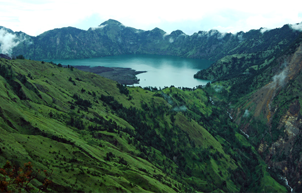
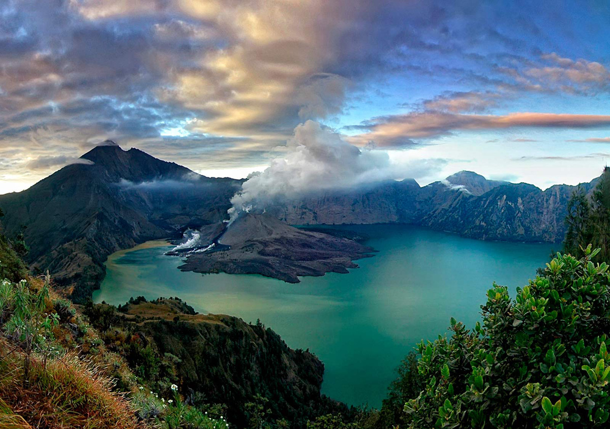
The mighty Rinjani mountain of Gunung Rinjani is a massive volcano which towers over the island of Lombok. A climb to the top is one of the most exhilarating experiences you can have in Indonesia. At 3,726 meters tall, Gunung Rinjani is the second highest mountain in Indonesia. The climb to the top may not be easy but it’s worth it, and is widely regarded as one of the best views in the country. 

Part of the famous ‘ring of fire’ this mountain also holds spiritual significance for the local people. It’s thought that the name Rinjani comes from an old Javanese term for ‘God’. 

Around the slopes of Rinjani there are lush forests sprinkled with waterfalls and surrounded by stunning scenery. 

Within the mountain is a crescent shaped lake, the breathtaking Segara Anak which is about 6km across at its widest point. This lake of sulfur is located 600 meters below the crater rim. Rising from the waters of this lake is a new volcano, Mt. Baru, which is a result of a series of eruptions during the 1990’s. Segara Anak is a spiritual place. The Balinese come here each year and perform a ceremony called pekelan where jewelry is placed in the lake as an offering to the mountain spirit. The Wetu Telu people also regard the lake as holy and come here to pray on full moon nights. 

Mt Rinjani lies within the Gunung Rinjani National Park. The park covers 41,330 hectares and sits inside a major bio-geographical transition zone (Wallacea). This is where the tropical flora and fauna of South East Asia meets that of Australasia. This National Park was established in 1997 and is one of over 40 throughout Indonesia.

For visitors, the three-day Rinjani trek route from Senaru to the crater rim, down to the Crater Lake then on to Sembalun Lawang, is considered one of the best treks in South East Asia. More adventurous trekkers may want to head all the way to the summit of the volcano. This is best reached from Sembalun Lawang and takes four days, finishing up in Senaru. 

To ensure that local communities benefit from tourism revenue, the Rinjani Trek is managed by a partnership of National Park officials, the public and private sectors of the Lombok tourism industry and community representatives. Community run cooperatives coordinate the Trek at the Rinjani Trek Center (RTC) in Senaru and the Rinjani Information Center (RIC) in Sembalun Lawang. 

Revenue from tourism activities and entry fees is used for conservation, management and assisting the National Park with maintenance of the Rinjani Trek, thus ensuring its sustainability. This management model is unique in Indonesia and considered an example of best practice of ecotourism in Indonesia.

Get There

Senaru and Sembalun Lawang Villages are the two starting points to climb Gunung Rinjani. Senaru Village is a three hour drive north of Mataram, while Sembalun Lawang Village is approximately a four hours drive to the east of Mataram.

You can get to Senaru by taking public transport to Bayan and then walking. 

The climb is not to be taken lightly. You need good hiking boots. Once you arrive at the crater rim it tends to get cold and windy, so you will also need warm clothes. 

A guide is essential as parts of the path are indistinct. Independent hiking is not recommended. 

Don't go there during the rainy season since paths will be slippery. Often it is not possible to climb during rainy season due to the hazard of falling rocks. 

It's better to bring your own sleeping bag but, if you don't have one, they can be hired.

Tents can be rented.

To Do

Nothing says challenge like climbing up an active volcano. Trekking up Mt Rinjani is a test of endurance but you’ll be rewarded with spectacular views of volcanic landscapes, sulfur lakes and waterfalls and other magnificent scenery along the way. Once you’ve climbed the mountain, there are still many wonders left to explore in the park. 

Discover secluded caves. There are three famous caves here Goa Susu, Goa Payung, and Goa Manik. Susu Cave is a good place for self reflection and is often used as a place to meditate.

Rejuvenate in the healing hot springs. The network of springs, called kokok putih, are the perfect place to rest your weary body. Locals believe the springs have healing powers. Water is collected from here and mixed with herbs to make medicinal oil. This is called Siu Satus Tunggal or in Bayan language Siu Satunggal which means that it can be used to cure a thousand types of disease.

Local strawberries grow along the route to Mt. Rinjani. While the fruit is red like a strawberry it has thorns like a rose. This fruit has a sweet and slightly sour taste and is good to eat, especially for trekkers who are hungry and thirsty.

The Eternal Flower or Edelweiss is a rare and precious plant. The flower cannot be removed from the park. It is a part of the mysterious world of the spirit kingdom. In the past, someone who wanted this flower had to be brave enough to fight and gamble his soul. That is why the flower is called Sandar Nyawa. 

Gunung Baru is the name of the new volcano which emerged in the center of Segara Anak Lake. People believe that Gunung Baru is the navel of Gunung Rinjani. 

Tetebatu is a village nestled on the slopes of Rinjani with magnificent views of rice paddies and tobacco plantations. From here, hire a guide to take you to Taman Wisata Tetabu (Monkey Forest) where you’ll find cheeky black monkeys and spectacular waterfalls. 

Guided village tours can also provide a glimpse of local culture and the opportunity to meet the locals.

Long Island, Jepara

Long Island, Jepara

City of Jepara, Central Java was not just Publications alone. There are still other islands can be visited, such as Long Island. Still virgin and deserted the main attraction of the Long Island.

For those who had planned to spend the holiday on the island of Karimun, you should be ready by the height of the island by other visitors. Although nature is presented very beautiful, but the bustling atmosphere can make the holidays feel less comfortable.
Long Island, Jepara
Still in Jepara, Central Java, Long Island presents a charm that is not inferior to Publications. It is located approximately 2.5 miles west Coast Kartini. Kartini Beach Pier, Long Island can be reached by boat only travel about 10 minutes.

When up in Long Island, you've immediately presented with a very beautiful natural scenery. Long Island has an area of approximately 19 hectares. The central part of the island is a mini-sized tropical forests with large trees. This location is very suitable to be used as a place of exploration at night.
Long Island, Jepara
Morning, fresh air and stunning scenery will spoil yourself. Unfortunately if this is just seen as beautiful scenery alone. Hurry save your stuff and start enjoying all the charm of Long Island. Take a walk on the lips patai be the most interesting activities here.

The island has a beach with sand very clean, because it is not too many tourists who come. Fun, Long Island surrounded by a shallow sea. So visitors can safely enjoy the sea to far from the beach. The sea bottom is a beautiful coral reef. Crystal clear sea can also be said and do not have current calm.

Setting up a snorkel or diving equipment is mandatory if you come to Long Island. Underwater natural scenery is very beautiful and do not lose the island of Karimun.

Source : http://travel.detik.com/

Pantai Panjang, the Long Beach of Bengkulu


Pantai Panjang, translated to mean Long Beach, boasts a coastline of fine, white sands that stretches 7 kilometers. As the beach has no reefs, its width expands to 500 meters when the tide is low.The beach area is a central tourism district and is lined with restaurants, hotels, cottages and shops. Pantai Panjang is located just 15 minutes from downtown Bengkulu, Southwest of the island of Sumatera.

Unlike many beaches, Pantai Panjang has no coconut or palm trees, but is dominated by Spruces and Pines which create a lovely shelter for beach-goers to rest and relax under. As a prime tourist area, a variety of facilities are positioned along the beach such as restaurants, cafes, accommodations, a children’s playground as well as sports facilities.

The Bengkulu community also uses the beach as a place for jogging in the mornings and evenings.
To Do

Pantai Panjang is coated with exceptionally fine sand that will not hurt your feet, making it perfect for long strolls or a morning jog. The waves are not too choppy, so feel free to play in the water, go swimming or fishing.

The outskirts of the beach are lined with rows of fragrant spruce and pine trees, complementing the beauty of the soft, white sands and shining sun.

The afternoon is the ideal time to go to the beach as the weather will be cool. Stick around long enough for evening to come around, and watch the colors of the horizon light up in the glow of the setting sun.

The beach is also a popular place for travellers to set up camp for the night.

About 5 kilometers from Pantai Panjang is Danau Dendam Tak Sudah, or Lake of Never-ending Revenge, which is surrounded by rolling green hills and is habitat for several rare species of fish.

Another interesting place to visit is the tea plantation in Kabewatan, Kepahiang, about 60 kilometers from Bengkulu’s city center.
Get There

Fatmawati Airport in Bengkulu is a domestic airport, serving onlyJakarta and Batam.

Pantai Panjang is located to the west of the city along Jalan Parawisata Kota Bengkulu. The beach is just 1.5 kilometers from the city center and is easily accessible by car, minibus, taxi or motorcycle.

Public transportation is available at all times, or you could try the more traditional forms of transportation such as the horse carts and carriages.

Source : www.indonesia.travel

Ujung Genteng Beach, Sukabumi


The beauty of the south coast await you where the waves accompanied horizon clean and white sand presenting exciting alienation. Edge tiles presents a natural symphony reassuring and arbitrate all the fatigue. Greet beauty in combination spectrum of waves and sky and sea blue clashing.

Location Coastal Edge tiles are in the region Pangumbahan Beach, District Ciracap, Sukabumi at the distance of about 220 km from Jakarta and 230 km from the city of Bandung, and 120 km from the town of Sukabumi. In addition to running pretty smooth as well, there are several alternative paths and adequate public transportation to the destination.

Edge tiles located quite far but its beauty is truly complete until made so close to your heart. It takes patience to get to this place. Prior to the coastline, you have to go through a winding road but when the foot stepped on the coastline, the ripple of the waves of the Indian Ocean will make you forget the fatigue. Corals sprawling along the dazzling white sand makes the heart fascinated sheer beauty.

This is where you will enjoy the crystal clear sea water and clean beaches. On this beach you can also join the fishermen catch lobsters. Although facing the Indian Ocean, but the waves are big no harm because first broke scattered unobstructed sea coral group in front of the beach. This place will spoil you with nature with beautiful beaches, safe, and comfortable.

With a length of about 16 km coastline heading west make Edge tiles as the most beautiful sights along the south coast. Its beauty is not less than Pelabuhan Ratu Beach which had already famous.

On the Edge tiles, in addition to the waves that roll, rock cliffs, and the sprawling white sand, there are also Muara Cipanarikan. This estuary meeting place Cipanarikan River which divides wildlife refuges Cikepuh with sea water. Before getting into the sea, the water of the river winding snake forming a groove running, thus forming a very wide stretch of sand.

Not a few tourists who come from outside the region of Sukabumi such as Jakarta, Bogor, Bandung, and so on. They come in groups by using a motorcycle (touring). This is because the motorcycle all the way to the tourist spots this past places that have incredible scenery beautiful. These Sukabumi, Palabuhan Queen, Cigaru a favorite route for this tour touring troupe. From Cisarakan you can enjoy the extraordinary landscape and the stretch of coast Palabuan Queen obvious.

In the colonial period, Edge Tile is a dock for Dutch ships sailing in the Indian Ocean. When the Japanese ruling, utilizing this beach to transport the natural result of Sukabumi. Currently the only remaining debris. Only solid walls and foundation breakwater lighthouse still visible.
Activity

The beauty of this beach is really refreshing, waist wide beach is quite spread out your feelings. Barefoot was the one and feel the sand beach menyeruap in between fingers. Your ears really infiltrated only the roar of the waves and the wind boisterous.

On the Edge tiles you can see directly the green turtle (Chelonia mydas) precisely on the beach Pangumbahan. Whenever lay eggs, turtle can produce 100 eggs. Usually turtles will lay eggs went ashore night to make a hole. Events turtles nest is performing very awaited visitors. In this place there are four endemic species of sea turtles Edge tiles. However, their habitats began to decrease, only a common Green Sea Turtles lay eggs. If you want to see turtles laying eggs are advised not to make a fuss, because this will make the turtle reluctant to spawn. After the turtles lay their eggs with the help of a flashlight and a stick you can dig a hole to lay eggs. Depth can reach 1 meter or more.

Locate surfing "Seven Waves" which is a favorite area for foreign tourists surfing. Seven Waves designation according to the population because the wave is always a sequence of seven large waves. Around the Seven Waves, there are several small islands that has a beach that is rarely touched.

For you who love fishing, the Edge Tile is a suitable place where the fish are many and varied.

Edge tiles also have the attraction of coconut sugar making process by the local community. Simple construction by installing bowl to accommodate the liquid from coconuts and flowers are gathered and cooked in a large pot and then printed with a piece of bamboo that is larger than the size of the palm sugar on the market.

Visit Cibuaya also is a very fitting place for bathing or swimming. The shape of the coastal basin with depths varying between 0.5 meters to 6 meters. You will find in it the beautiful coral reefs and enjoy the sunrise from the forest behind Cikepuh or sunset at the end of the ocean. For those who like fishing, Cibuaya a very suitable place because Snapper and Grouper many wandering in this location.

Cipanarikan estuary there are grains of sand are often so subtle arena of children's toys. They run around or form a picture or writing his own name. When you browse the many beaches found ornamental fish swimming freely in the sidelines of the cliff. In this estuary are many marine animals, such as crabs, grouse, lizards, and fish estuary.

Tips

Journey to the Edge Tile Beach can be reached in approximately 3-4 hours from the city of Sukabumi with private vehicles. We recommend that you prepare with gasoline fully charged in case where it may be difficult to get SPBU.Bawalah enough food and beverages as a provision in the journey and the destination

Transportation

Coastal Edge tiles are in Sukabumi. This place can be achieved through Jampangkulon-Surade, the capital district nearby. Vehicles can easily reach the beach Edge tiles, even also have the public transport leading to the Edge tiles.

Travel to the Edge tiles can be reached for 6-8 hours, depending on congestion in Sukabumi, Path towards the summit. The road is paved, is quite good, although sometimes in some places perforated so caution. Only the transportation of Edge tiles to places around the still limited, due to the road conditions and infrastructure.

End tile itself is actually including the District Ciracap, but the name is more closely Edge tiles with small town Surade as a transit point for tourists visiting the Edge tiles using public transport. In addition, means of public transport vehicles are also more common in Surade. From Surade you can go on to the End of tiles by using public transport smaller or so-called "unyil" by society.

To reach the beach Edge tiles located approximately 5 km from the main road. You can hire a motorcycle that has been experienced as a guide for getting there must pass through a path that is only just 1 car and has not been paved also pass through small rivers and roads are slippery when it rains. A motorcycle taxi services as a guide of resident fee is 30-50 thousand dollars.
Route 1: Your path through the Jakarta-Ciawi-Cicurug-Cibadak about 2.5 hours. Then point Cibadak-Pelabuhan Ratu-Cikembar-Jampang Kulon-Surade-Edge GentengRute 2: you past the point of Jakarta-Ciawi-Cicurug-Cibadak-Sukabumi-Middle-Jampang Jampang Kulon-Surade-Edge Genteng.Rute 3: you past the point Bandung- Cianjur-Sukabumi-Middle-Jampang Jampang Kulon-Surade-Edge tiles.

Using Public Transportation
• Jakarta - Bogor - Sukabumi - Overtime Situ - Surade - Edge Tile
o Jakarta - Bogor Rp 8,000, -
o Bogor - Sukabumi (elf) Rp 10.000, -
o Sukabumi - there Overtime Rp 3,000, -
o Overtime Situ - Surade Rp 20.000, -
o Surade - Edge Tile Rp 10.000, -

• Bandung - Sukabumi - Overtime Situ - Surade - Edge Tile
o Bandung - Sukabumi Rp 20.000, -
o Sukabumi - there Overtime Rp 3,000, -
o Overtime Situ - Surade Rp 20.000, -
o Surade - Edge Tile Rp 10.000, -

www.indonesia.travel

Saturday, November 22, 2014

Ora Beach


As the country with the second longest coastline in the world, Indonesia is home to countless beautiful beaches, and has won numerous awards for such. One of these beaches is Ora Beach, carefully hidden away on the North Coast of Seram Island. An exotic and extremely remote destination, Ora beach is perfect for Eco-travellers and honeymooners alike. A row of cozy, wooden cottages line the sandy, white beaches, overlooking the crystal clear waters of Sawai Bay, and with a backdrop of limestone cliffs and majestic mountains, covered in lush, tropical greenery. Seram island is most famous for its abundant bird life. Of 117 species found on the island, 14 are endemic to Seram.

Seram is the largest island in the Maluku province, measuring approximately 16,000 square kilometers, yet is home to a population of only about 170,000. It lies just north of the smaller and more historically renowned island of Ambon. Maluku Province is located between Indonesia’s larger islands of Sulawesi and Papua. Seram’s geographic location amidst several tectonic plates, gives the island a remarkably complex terrain. A central mountain range runs across the island, its highest mountain, Gunung Binaya, peaking at just over 3,000 meters. The island is covered mostly in dense, tropical rain forests, bordered on one side by towering cliffs and the other by sandy white beaches, and finally encircled by a crystal blue sea.


To Do

As a mountainous and heavily forested island, Seram offers many an opportunity for lovers of the great outdoors to go trekking, hiking, and the like. For those who have the patience, and a good eye, see how many of Seram’s unique birdlife you can spot!

The surrounding sea is crystal clear, and home to a stupendous display of colorful coral reefs, with a multitude of fish and other ocean creatures living therein; much of which is visible even before you submerse yourself beneath the glassy surface. Sawai Bay, facing Ora Beach, is the most popular spot on the island for diving and snorkeling, for a closer look at the magnificent underwater gardens and their inhabitants. There are no dive shops on Seram island, so visitors are advised to bring their own gear, or rent it from Ambon before embarking on the journey to Seram.

Many a visitor to Ora have stated that the day was not long enough to explore the ocean’s sights, resurfacing only at the day’s end to bask in the evening glow of the orange sun sinking beneath the horizon. Even once the last lingering lights have disappeared, the brilliant starlight is enough to keep you mesmerized until the sun revisits once again.


Tips

Make sure to bring enough cash from Ambon, as there are no ATMs or Banks on the island.

- As there is only one restaurant on Ora Beach, visitors are advised to bring their own food or snacks as well.

- If you plan to go diving or snorkeling, (which you should,) any equipment should be rented while in Ambon.

- Snorkeling should be done in deeper waters, because although shallow waters are equally abundant in corals, swimming in these waters could damage the reefs.

- Last but not least, do not litter, and please do your part to protect the environment.


To Stay

Ora Beach Resort is a family owned resort in this secluded part of Seram Island, and is only accessible by water.It is located between the Sawai Bay, rugged cliffs, forested peaks and Saleman village. The Resort comprises of 5 stilted bungalows, 6 standard rooms and a restaurant. Prices range from 1,000,000 – 1,500,000 rupiah per day, and include transport to and from Port Tulehu, as well as 3 meals a day.
Exotic Ora Beach
Seram Utara
Jln. Raya Waitatiri Ambon, Maluku
Phone +62-922-362717
Email: Orabeachresort@yahoo.com.
Facebook: Ora Beach Ambon Maluku
Alvin Latuconsina (+628170833554/+628111909404)

Get There

The first step is to catch a flight to Ambon Pattimura Airport. Ambon is a domestic only airport, with available flights from the nation’s capital of Jakarta, Surabaya,Makassar, and other cities around Indonesia.

From the airport, hire a car and make your way to Tulehu Port, which will take you about 30 minutes. From there, catch a Ferry toMasohi, on Seram Island. Tickets cost between 50,000 – 150,000 Rupiah, and the trip will take between 1.5 - 2 hours, depending on the type of vessel you choose. After that, it’s another 2 hours by car along steep and winding forested roads until you arrive at the tiny fishing village of Saleman. At last, the final leg of the journey will be yet another boat ride from the village to Ora Beach Resort, which thankfully, will only take about 10 minutes.

Source : http://www.indonesia.travel/

Pasumpahan Island


ALREADY recognized that the West Sumatra has a complete tour package. People say do not have far to go abroad, to West Sumatra just all there. Want kulineran, here the place. Want to see the architecture and culture, here condensed really. Want to find mountains and valleys, West Sumatra place.

If tourist destinations I mentioned just now certainly have a lot to know. It turns out that West Sumatra also has maritime tourism know. Certainly not many know that West Sumatra has a very beautiful island and beautiful. Here I want to share about Pasumpahan which is only 1 hour drive from the beach in the city of Padang.

West Sumatra has a wealth of natural and cultural community that is distinctive and unique. An area stretching from the west coast to the central Sumatran presents a unique experience and has made it as one of the best and favorite tourist destinations in the country.


BARRY KUSUMA Pasumpahan in West Sumatra
Located on the western shore of Sumatra, Padang became the most important city in West Sumatra province as well as the central government. In addition to the business and administrative center of the city, Padang could be an attractive haven for tourists before exploring elsewhere, thanks to a number of tourist sites in the vicinity.

Pasumpahan is an island in the waters of the Gulf Bungus District of sackcloth, Padang, West Sumatra. Therefore, the island is near if we use a speed boat from the Gulf Bungus located close to the city of Padang. Claims will be the beauty of the sea make this island began to be known by local and foreign tourists.

Pasumpahan located approximately 200 meters from Sikuai. The island has white sand beach tourism with coral reefs are still awake. In addition, the island became a shelter or a gathering of fishermen. On the beach we could see a lot of activity here that fishermen are catching fish and catch fish.


BARRY KUSUMA Pasumpahan in West Sumatra
The island is expected to be a leading tourist destination in West Sumatra. Located in the west of the island of Small Satan, to take the island takes 40 minutes from Banana Island with 45 PK machine.

Underwater tourism potential in the area of marine tourism west coast of Padang is in the form of regional coral reef ecosystems found in almost every island, including the islands Gosong. In addition to the various types of coral reef coral fish or ornamental fish are also very attractive to tourists enjoy.

In the waters of Padang found 21 species of fish butterflyfish Chaetodon dominated by trifascialis. The location-information gathered dives already on sale to tourists, among others Gosong Island, Snake Island, Sirandah Island, and Pulan Pandan.

Because beauty Pasumpahan and surrounding islands are now being targeted by many local and foreign investors to be developed as a tourist attraction seeded West Sumatra. Yes, because the potential for marine tourism in West Sumatra island is really nice and could be developed.


BARRY KUSUMA Pasumpahan in West Sumatra
Sand along the coast with waves Pasumpahan which became the main attraction of this beach. A tiny island floating off the coast, becoming a valuable bonus scenery. Landainya stretch of beach lined with billions of grains of white sand, quiet atmosphere is the flagship of the attraction of this island.

Thus, the tourists will feel isolated much hubbub of the city even though only a step away from the hustle of the city. Round the island would be fun. By walking tourists can witness the natural scenery around the island which is so pleasing to the eye. It is not wrong if Pasumpahan is referred to as one of the most beautiful island in West Sumatra. (BARRY KUSUMA)

Mount Bromo


This national park is named after its two mountains, Mount Semeru (the highest in Java at 3,676m), Mount Bromo (the most popular) and the Tengger people who inhabit the area.

Mount Semeru also known as Mahameru("Great Mountain"), is one of Indonesia's most active volcanoes. What stands out most about this mountain is the fact that it erupts periodically (and very reliably). Every 20min or so, the volcano belches out a huge cloud of steam and smoke, sometimes interspersed with ash and stones. Climbing Mount Semeru requires some planning and a permit from the national park authority. The mountain is often closed due to its highly active nature.

Mount Bromo (2,329m) is easily recognized as the entire top has been blown off and the crater inside constantly belches white sulphurous smoke. It sits inside the massive Tengger caldera. with a diameter of approximately 10km, surrounded by the Laut Pasir (Sea of Sand) of fine volcanic sand. The overall effect is unsettlingly unearthly, especially when compared to the lush green valleys all around the caldera.

The major access point is Cemoro Lawang (also Cemara Lawang or Cemora Lawang - blame the East Javanese accent!) at the northeastern edge of the caldera, but there are also trails from Tosari (northwest) and Ngadas (southwest). The village of Ngadisari, on the road from Probolinggo about 5.5km before Cemoro Lawang, marks the entrance to the national park. Both Cemoro Lawang and Ngadisari are rather picturesque, with brightly-painted houses and flower beds outside. 
The Tenggerese

Spectacular: The Tengger massif is bathed in dawn light as Mount Bromo spews red smoke

The area in and around the park is inhabited by the Tenggerese, one of the few significant Hindu communities left on the island of Java. The local religion is a remnant from the Majapahit era and therefore quite similar to that on Bali but with even more animist elements. The Tenggerese are believed to be descendants of the Majapahit princes and were driven into the hills after mass arrivals in the area of devoutly Muslim Madurese in the 19th century. These Madurese immigrants were labourers working for Dutch coffee plantation owners and the native Hindu people of the region soon found themselves outnumbered and either converted to Islam or fled to the inhospitable high mountain tops where they remain today.

The religion is quite low key though (certainly when compared to Bali) with the most visible manifestation of faith being the rather austere Poten temple in the sea of sand. The Tenggerese number about 600,000 and they reside in 30 villages scattered in and around the park with smaller communities elsewhere in East Java.

For many visitors, the sight of the angular-faced, sunburned, moustachioed Tenggerese wrapped in poncho-like blankets, trotting about on ponies with craggy mountains as the backdrop, more resembles Peru than Indonesia!


Landscape

If a landscape was ever needed to demonstrate the meaning of the phrase desolate beauty, then this is surely it. Rugged, barren volcanic peaks, gravel plains and that sea of sand. Truly unworldly.

The park also includes large areas which are very lush and green fed by rivers from the high tops. The medium elevations are clad with much thinner forest before this gives way to the barren plateau and peaks.
Get in


Get In


Mount Bromo is perhaps the most accessible of Java's active volcanoes and for that reason it gets a lot of domestic tourists, often in package groups. It is also a popular destination for high school groups who camp in the area. For that reason, those visitors seeking a quiet appreciation of the park should avoid major domestic holiday periods. That being said, this is a large park and providing you get away from the main watchpoint areas, quiet enjoyment is possible at any time, as long as the Tenggar caldera in the Mount Bromo volcano complex is not erupting as it did in 2004, late 2010 and early 2011. If so some caution may be required.


By plane 


The nearest major airport is in Surabaya (IATA: SUB), three to four hours away by car (and more by bus). Surabaya is well served by regular domestic flights from Jakarta and Bali and some other countries in Asia. Private cars can be arranged in the arrival hall. Fare for a drop off is around IDR600,000 and you may be able to get a car with driver (including fuel and tolls) for IDR500,000 after some negotiation (March 2014).
Abdul Rachman Saleh Airport (IATA: MLG) at Malang is a small regional airport with flights from Jakarta only and access from here makes sense if you intend to enter the park via the Tumpang/Ngadas route.

Source : http://wikitravel.org/

Prambanan Temple

Prambanan 12

STRUCTURE

The high structures are typical of Hindu architecture, and the plan of the temple complex is a Mandala, as is Borobudur.
As a symbol of the Hindu cosmos, the temple or candi is vertically into three parts, both vertically and in plan.

Bhurloka: The base of the temples, as well as the outer square is the underworld. A place for ordinary folk, mortals, both human and animal. The place where lust and desire are commonplace. This is an unholy area.

Bhuvarloka: The central body of the temples and the middle square of the complex, represents the ‘middle world’ the place for those who have left their worldly possessions. This is where people begin to see the light of truth.
Svarloka: The top of the temples, and the innermost square represents the realm of the gods, the holiest zone, and is crowned.

During the restoration of the Siva temple a well of over 5 metres depth was found, which contained a stone casket.

WORSHIPING ANCESTORS

It is understood that when a king or prominent person died, the ashes of the deceased along with various objects representing physical and spiritual symbols of the cosmos, were placed in a stone casket. This casket was placed in a shaft in the base of a temple, above it was built a statue of a god, of whom the deceased was said to be an incarnation. This statue then becomes the object of worship for those honouring and worshipping the king. Ancestor worship has been an Indonesian cultural tradition since prehistoric times, and it has been adapted into the local adaptions of Hinduism and Buddhism. Some archaeologists suggest that the idol of Shiva in the central chamber of the Prambanan’s main temple is modelled after King Balitung, of the Mataram Kingdom. One of the possible instigators of the temple building.

The casket found in the well of the Siva temple at Prambanan was sitting on a pile of charcoal, earth and animal bones. It contained a variety of objects, including, coins, jewels, precious metals and ashes. Gold sheets with inscriptions of Varuna, the god of the sea, and Parvata, the god of the mountains were also found.

BUILT OVER TIME

The temple complex was most likely built in stages. Estimated to have been commenced during the late 9th and early 10th Century, by either Rakai Pikatan or Balitung Maha Sambu the Sanjaya king of the Mataram Kingdom. It is suggested that it was built as a Hindu response to the Buddhist Borobudur, which was built by the concurrent Saliendra dynasty.

The temple complex was expanded in stages by successive Mataram kings, with the addition of the hundreds of ‘perwara’ temples around the central temples. Prambanan was used by the Mataram royal family for its religious ceremonies and sacrifices.

Just like Borobudur, when power moved to western Java around 930AD the Prambanan temples were left abandoned and suffered the ravages of earthquakes and nature before being rediscovered.

A large earthquake in the 16th Century led to a further collapse of the temples.
Dutchman CA Lons wrote a report on the state of the temple in 1733, with a great deal of the temple being under ground and covered with plants.The British also surveyed the ruins after Collin Mackenzie under Sir Stamford Raffles came across the temple ruins by chance in 1811. Restoration works commenced in 1830, the main Siva temple was completed in 1953, and works continue to this day. An earthquake in 1996 did cause further damage to Prambanan and many other temples in the area. The local Hindus, often of

Balinese heritage, have revived Prambanan as a religious venue, performing their ceremonies and rituals here.

Close by and within the archeological park, are the lesser known Sewu, Bubrah, and Lumbung Temples, all Buddhist, demonstrating the religious harmony experienced in Indonesia throughout the ages.

Source : http://www.borobudurpark.co.id

Borobudur temple

Borobudur Temple 14

Borobudur temple is built to represent many layers of Buddhist theory. From a birds eye view, the temple is in the shape of a traditional Buddhist mandala. A mandala is central to a great deal of Buddhist and Hindu art, the basic form of most Hindu and Buddhist mandalas is a square with four entry points, and a circular centre point. Working from the exterior to the interior, three zones of consciousness are represented, with the central sphere representing unconsciousness or Nirvana.


Zone 1 Kamadhatu
The phenomenal world, the world inhabited by common people.

This base level of Borobudur has been covered by a supporting foundation, so is hidden from view. During an investigation by JW Yzerman in 1885 the original foot was discovered. Borobudur’s hidden Kamadhatu level consists of 160 reliefs depicting scenes of Karmawibhangga Sutra, the law of cause and effect. Illustrating the human behaviour of desire, the reliefs depict robbing, killing, rape, torture and defamation. 

Evidence suggests that the additional base was added during the original construction of the temple. The reason for adding the base is not 100% certain, but likely to be either for stability of the structure, to prevent the base from moving, or for religious reasons - to cover up the more salacious content. The added base is 3.6m in height and 6.5m wide.

A corner of the covering base has been permanently removed to allow visitors to see the hidden foot, and some of the reliefs. See image to the right.

Photography of the entire collection of 160 reliefs is displayed at the Borobudur Museum which is within the Borobudur Archeological Park.

Zone 2 Rapadhatu
The transitional sphere, in which humans are released from worldly matters.

The four square levels of Rapadhatu contain galleries of carved stone reliefs, as well as a chain of niches containing statues of Buddha. In total there are 328 Buddhas on these balustraded levels which also have a great deal of purely ornate reliefs .

The Sanskrit manuscripts that are depicted on this level over 1 300 reliefs are Gandhawyuha, Lalitawistara, Jataka and Awadana. They stretch for 2.5km. In addition there are 1 212 decorative panels.

Zone 3 Arupadhatu
The highest sphere, the abode of the gods.

The three circular terraces leading to a central dome or stupa represent the rising above the world, and these terraces are a great deal less ornate, the purity of form is paramount.

The terraces contain circles of perforated stupas, an inverted bell shape, containing sculptures of Buddha, who face outward from the temple. There are 72 of these stupas in total. The impressive central stupa is currently not as high as the original version, which rose 42m above ground level, the base is 9.9m in diameter. Unlike the stupas surrounding it, the central stupa is empty and conflicting reports suggest that the central void contained relics, and other reports suggest it has always been empty.


HAND OUT

The total of 504 Buddhas are in meditative pose, and the 6 different hand positions represented throughout the temple, often according to the direction the Buddha faces.

These ‘mudra’ symbolise concepts such as charity, reasoning and fearlessness, it is said they tell a story that Buddha’s serene face does not.


RESTORATION

Borobudur was left to the ravages of nature in the 8th Century when the power of Java shifted to the East of the island. The reason for this shift is unknown, but it is often speculated that there was a volcanic eruption and people moved to be away from it.

There are manuscripts that relate stories of Javanese re-visiting the site in the 18th Century. But it was the ‘re-discovery’ by the British Sir Stamford Raffles in 1814 that led to greater recognition and also preservation efforts.

In 1815 Raffles commissioned an initial clean up, where 200 labourers spent 45 days felling trees and moving earth from the remains. Many areas of the temple were sagging.

Activities continued with documentation and interpretation of the reliefs. It was during the work of Ijzerman in 1885 that the hidden reliefs at the base of the temple were discovered. It was these hidden reliefs that also revealed some Sanskrit instructions left for the carver, with lettering that was sodistinctive that the

construction of the temple was able to be dated, to the middle of the 9th century, during the time of the Saliendra dynasty reign.
A few scenes had been left unfinished, with instructions to the stone carver inscribed in Sanskrit, and the style of lettering is so distinctive that it can be dated specifically to the middle of the 9th century.In 1907 a large scale restoration was carried out under Dutchman Van Erp that finished in 1911. The work was significant and definitely safeguarded the temple for some time. However, many of the pieces were not put back in their original positions during the restoration.


In 1956 another assessment of the temple was made by a Belgian expert who was sent by UNESCO. His assessment concluded that water damage was significant, and would need to be stemmed if the temple was to have a long term future. The hill below the temple was eroding, the foundations were being weakened and also the reliefs were being eroded. 


Preparatory work began in 1963, which amongst other things discovered that the hill was not a natural hill as had always been assumed, but areas of it were loamy soil, mixed with stones and stone chips. The initial work assessed the scale of a restoration to be gigantic, and the Indonesian Government then submitted a proposal to UNESCO in 1968 outlining the works needed.

UNESCO gave full support and commenced work to raise funds for the restoration. From 1968 to 1983, research through to restoration took place under UNESCO. Specialists from the world over came to assist in the dismantling, and re-engineering of the site. A great deal of work was also done to develop procedures to prevent the microorganisms eating away the stone. 

The UNESCO world heritage listing of Borobudur Temple was inscribed in 1991.

THE TEMPLE CORRIDOR


Accurately in line with Borobudur are two smaller temples, Pawon and Mendut. Given the time in which these temples were built, the accurate positioning achieved remains a mystery. Pawon is 1.15km, and Mendut 3km from Borobudur.

The three temples are used to form a route for the Waisak day festival each year. Held each year on the day of the full moon in April or May the festival commemorates the birth, enlightenment and death of Gautama Buddha.
This important day in the Buddhist calendar sees many local and international pilgrims walk in procession from Mendut, through to Pawon and then on to Borobudur. It is a colourful and festive occasion supported by the Indonesian government.


Source : http://www.borobudurpark.co.id