Showing posts with label National Park. Show all posts

Tuesday, December 2, 2014

Lorentz National Park, Papua


Lorentz National Park is located in the Indonesian province of Papua, formerly known as Irian Jaya (western New Guinea). With an area of 25,056 km2 (9,674 mi2), it is the largest national park in South-East Asia. In 1999 Lorentz was declared a World Heritage Site by UNESCO.

An outstanding example of the biodiversity of New Guinea, Lorentz is one of the most ecologically diverse national parks in the world. It is the only nature reserve in the Asia-Pacific region to contain a full altitudinal array of ecosystems ranging through marine areas, mangroves, tidal and freshwater swamp forest, lowland and montane rainforest, alpine tundra, and equatorial glaciers. At 4884 meters, Puncak Jaya (formerly Carstensz Pyramid) is the tallest mountain between the Himalayas and the Andes.

Birdlife International has called Lorentz Park “probably the single most important reserve in New Guinea”. It contains five of World Wildlife Fund's "Global 200" ecoregions: Southern New Guinea Lowland Forests; New Guinea Montane Forests; New Guinea Central Range Subalpine Grasslands; New Guinea Mangroves; and New Guinea Rivers and Streams.

Lorentz Park contains many unmapped and unexplored areas, and is certain to contain many species of plants and animals as yet unknown to Western science. Local communities' ethnobotanical and ethnozoological knowledge of the Lorentz biota is also very poorly documented.

The park is named for Hendrikus Albertus Lorentz, a Dutch explorer who passed through the area on his 1909–10 expedition.


Fauna

The Southern Crowned Pigeon found in Lorentz is confined to the southern lowland forests of New Guinea.
Lorentz National Park has 630 documented species of bird (around 70% of the total number of bird species in Papua) and 123 mammalian species. Birds include two species of cassowary, 31 dove and pigeon species, 31 species of cockatoo, 13 species of kingfisher and 29 species of sunbird. Six bird species are endemic to the Snow Mountains including the Snow Mountain Quail and Snow Mountain Robin, 26 species are endemic to the Central Papuan Ranges while three are endemic to the South Papuan Lowlands. Threatened species include the Southern Cassowary, Southern Crowned Pigeon, Pesquet's Parrot, Salvadori's Teal and Macgregor's Giant Honeyeater.

The mammal species include the Long-beaked echidna, Short-beaked Echidna, and four species of cuscus as well as wallabies, wildcats and tree-kangaroos. Endemic to the Sudirman Range is the Dingiso, a tree-kangaroo species only discovered in 1995.


Human habitation and culture

The area of the national park has been inhabited for more than 25,000 years. The forests of Lorentz encompass the traditional lands of eight indigenous ethnic groups,[4] including the Asmat, Amungme, Dani, Sempan, and Nduga. Estimates of the current population vary between 6,300 and 10,000.

It is widely acknowledged that conservation management strategies for the park will have to incorporate the needs and aspirations of these peoples if the park is to succeed in protecting biodiversity. Moreover, cultural diversity is another important measure of success for the park.


The main threats to the biodiversity of Lorentz are from commercial logging, forest conversion for plantation agriculture, smallholder agricultural conversion, mining/oil/gas development, illegal road construction, and the illegal species trade. Global warming also poses a substantial threat.

As of 2005, there was no reported commercial logging or other large-scale threats present inside the park. There are no currently active forest conversion projects, and agricultural conversion is minimal. The illegal species trade is known to be a serious problem. The large Freeport gold/copper mining operation has been active for decades to the west and north of the park but is not active inside the park boundaries. Oil exploration inside and to the northeast of the park is ongoing.

The overall health of the biodiversity of Lorentz Park is currently excellent. While logging and other threats have yet to materialize, it is likely that this will become a threat in the future. Climate change poses a very real threat, but its specific implications for Lorentz are uncertain.


Conservation

The first formal protection of a 3,000 km² core area of the Lorentz landscape was applied by the Dutch Colonial Government in 1919 with the establishment of the Lorentz Nature Monument. In 1978, the Indonesian Government established a Strict Nature Reserve with an area of 21,500 km². Lorentz National Park was established in 1997, with a total area of 25,056 km², including an eastern extension and coastal and marine areas.

Lorentz National Park was listed as a natural World Heritage Site in 1999, however an area of about 1,500 km² was excluded from listing due to the presence of mining exploration titles within the park.

As of 2005, there were no park staff or guards assigned to Lorentz. However, the park's success largely depends on local communities' understanding of and support for conservation, rather than external enforcement alone. Several conservation organizations are working in the Lorentz area.

In 2006, the Minister of Forestry established a managing structure for Lorentz National Park, the Lorentz National Park Bureau with headquarters in Wamena. The Bureau became functional only in 2007, and reached a staffing of 44 in mid-2008. However an UNESCO Monitoring Mission in 2008 acknowledged that the capacity of the Bureau was seriously limited due to lack of funding, equipment and experience.

Saturday, November 29, 2014

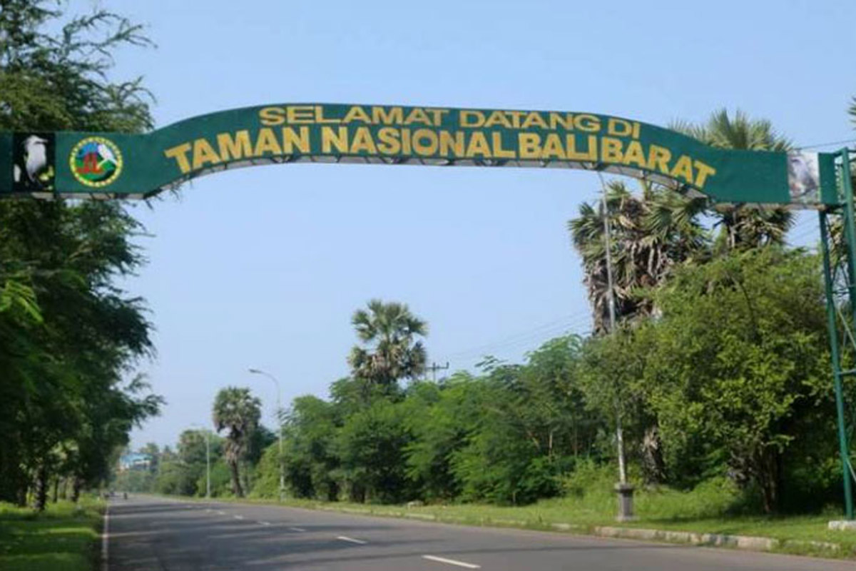
West Bali National Park

Overview

West Bali National Park (Taman Nasional Bali Barat in Bahasa Indonesia) is the most north-westerly point of Bali. It includes the whole of the Prapat Agung Peninsula, and large swathes of land around the towns of Gilimanuk, Cekik and Banyuwedang. The official area inside the park boundaries is 190 square kilometres, with a further 580 square kilometres of protected reserve in the highlands to the east. In total this accounts for some ten percent of Bali's total land area.

History

The park was first officially recognised as an area of importance in 1917 when the council of Bali rulers designated it as a nature park. It was fully established as an Indonesian National Park in 1941.


Landscape

The habitat is very varied with rainforest, dry savanna, acacia scrub and lowland forests, as well as more montane forests in the higher centre. There are also some pockets of dense mangrove forest.
In the north of the park there is an obvious north jutting peninsula called Prapat Agung. Around this peninsula there are long stretches of protected beach and offshore coral reef as well, as a small offshore island called Menjangan. The latter is a very popular diving destination.
There are several long extinct volcanoes in the protected reserve area to the east, with Mount Patas (1,412 metres) and Mount Merbuk (1,388 metres) being the highest points. These peaks are dominant visual landscape features from within every area of the park.


Flora and fauna

Bali Starling
One hundred and sixty species of bird have been recorded in the park, including the near extinct Bali Starling, Bali's only endemic vertebrate species, and a key reason why this national park was created in the first place. By 2001, as few as six individuals were thought to survive in the wild, all of them in this park. Since then captive breeding and re-introduction efforts have continued apace, but poaching pressures are a large problem. With that in mind, a seconf re-introduction programme was started in remote regions of Nusa Penida in 2004. Keen birdwatchers can find a checklist of likely species and their status here .
Mammals found inside the park include Banteng, a species of wild cattle from which the familiar Bali cows are descended. Java Rusa and Indian Muntjac deer are quite widespread, and Menjangan Island is in fact named after these (Menjangan means deer in Bahasa Indonesia). Wild Boar and Leopard Cats are both quite common but seldom encoutered.
A Bali Tiger (a full sub-species of Tiger) was shot here in 1937, and despite rumours to the contrary, that is the last ever confirmed sighting of an animal considered extinct since that moment.

Climate

Not noticeably different from the rest of Bali or eastern Java, but it may feel a little hotter and drier in the dry season here than in southern parts of Bali.
Bali is always warm, humid and tropical, remaining around 30-35°C (85-95°F) all year round. The April-October dry season and November-March rainy seasons are only relative, with plenty of rainfall around the year, but the Balinese winter is cloudier, more humid and with a higher chance of thunderstorms.
Bali Barat National Park Office HQ, Jl Raya Cekik-Gilimanuk, Jembrana, Bali 82253, ☎ +62 365 61060 (tnbb@telkom.net, fax: +62 365 61479), [2]. 7:30AM-5PM.  edit
Bali Barat National Park Vistor's Centre, Labuhan Lalang,

Get in

Most visitors to the park arrive along the north coast road from Lovina (about 90 minutes) or Pemuteran (about 15 minutes). Others come from the south via Gilimanuk (about 15 minutes)
All visitors should check in at one of the two park offices (PHPA) for information, and to purchase permits and arrange guides. The headquarters is at the village of Cekik just south of the Gilimanuk in the west. The other is at Labuan Lalang on the north coast from where boats to Menjangan Island depart. The main ranger station is on the road between the two offices at Sumber Klampok.
The park staff are welcoming, helpful and will arrange guided tours for you. Most hotels in the area arrange guided tours, but if you want a more customized experience it is advisable to directly talk to the guides at the partk offices.
For example, Putu Arta in the Labuan Lalang office (+62 813 38399576) is an experienced and enthusiastic guide, who is happy to share his extensive knowledge of the flora and fauna of West Bali National Park with you.


Fees/Permits

Permits and obligatory guides are available at the park headquarters at Cekik and the office at Labuhan Lalang. The official permit charge is Rp 25,000 per person. The cost of a guide is negotiable. Use your common sense and do not be tight. Fees for the official guides have become fixed. at one office at 350,000 rupiah for a two hour hike. Official guides, however, will demand the official price (for foreigners) of 200,000 per person for a 3 hour hike (2013 rate). As of 15 July 2014 entry fees increased to Rp 200,000 for foreigners with additional surcharges depending on activity.
Get around

Only a small percentage of the total area of the park is open to visitors, and this rule must be respected. There are two key ways to explore the park: either hiking the trails or concentrating on marine aspects.
Walking the trails must be done with an official guide from one of the national park offices (most normally the one at Cekik). Boat trips to Menjangan and around Gilimanuk Bay can be organised in advance (ask at your hotel), or by charter on the day you arrive.
Persons expecting to wander through a tropical rain forest might be very disappointed with the hikes, as the trees are mostly deciduous, with a rather open ground cover.
See and do

The official park trails should be explored with a guide recommended by the national park ofice. This is actually a rule but it is sometimes 'quietly' ignored. Please do not do this nor encourage the practice, despite the very irresponsible advice given in some printed travel guides to do so.
The Tegal Blunder Trail is most popular with birdwatchers, and it is an easy two hour walk. The ranger checkpoint is at the village of Slumber Klampok about 20 minutes west of Cekik. From the same checkpoint you can take the more strenuous Gunung Klatakan Trail to the south east. This is tougher walking for about five hours, but it takes you through some memorable rainforest. There are other trails and opportunities for interesting hikes, but these are the two most popular and the easiest. Ask guides about other opportunities at the time, particularly those involving hiking deeper into the Prapat Agung Peninsula.
The uninhabited Menjangan Island is a must-do for any visitor to Bali interested in marine life, snorkelling or diving. Boats leave from the beach at Labuan Lalang at the northern edge of Teluk Terima bay, and can chartered on the day. Groups of tourists often club together at Labuan Lalang in the mornings for that very purpose. Any boat charter must be accompanied by a guide, and you must purchase a permit (Rp 25,000 per person) from the national park office in the main Labuhan Lalang car park. Many of Bali's dive operators based in the southern tourist regions offer dive excursions specifically to Menjangan. The snorkelling here is probably the best on Bali with good clear water and calm seas.
There is a notable temple on Menjangan called Puri Gili Kencana which is certainly worth a visit. You can walk around the whole of Menjangan in about 1 hour and 15 minutes. If you take it slower though there is plenty of natural coastal beauty to absorb.
Gilimanuk Bay snakes into the south western tip of the Prapat Agung peninsula, and the park office can arrange a guided boat trip for you in a traditional outrigger. Expect to pay about Rp 300,000 per hour including guide fees. The bay is quiet and supports a rich diverstity of marine life. There are some notable areas of mangrove forest fringing the bay, and these act as a natural nursery for the diverse fish life in the area.


Lodging

There is one official high end resort inside the boundaries of the national park on the Prapat Agung peninsula. There is no other accommodation inside the park. Visitors on a lower budget day trip the park from Gilimanuk, Pemuteran or Lovina where there are ranges of accommodation to suit all budgets.
There is popular budget accommodation about two km north of the Cekik park headquarters office on the road to Gilimanuk called Pondok Wisata Lestari, tel: +62 365 61504.

The Menjangan, ☎ +62 362 94700 (bliss@themenjangan.com). Member of Lifestyle Retreats, West Bali National Park.The Menjangan is the largest Resort with 382 hectares within the boundaries of the Bali Barat National Park. Offering 22 elegant rooms. The Monsoon Forest Lodge with 14 rooms set around an idyllic pool and Jacuzzi, 7 stunning Balinese Villas (100sqm) at the shores of your own private Balinese Beach. 1 Residence with private butler service (1,000 sqm) with two double bedrooms and one twin bedroom all with en-suite bathrooms and private balconies overlooking Bajul Bay, including a private infinity pool. Offering delicious and healthy cuisine in their two Restaurants, one directly on the Sentigi Beach. Lots of activities such as horse back riding, snorkeling, diving PADI Divecenter, bird watching, hiking tours, kayaking. Peaceful Spa Center offering great views from the four Gazebo treatment rooms. Free WiFi and 24-hours concierge service. 
Waka Shorea, ☎ 62 361 484085 (info@wakaexperience.com). Just 16 rooms at this understated, five star resort which offers a full range of national park based activities. In-house spa, superb restaurant and everything else you would expect at a 5 star resort. Has a reception area adjacent to the public boat jetty at Labuhan Lalang, from where you jump into to a boat to reach the resort. The only accommodation inside the boundaries of the park. From US$185.
Mimpi Resort Mejangan, Banyuwedang, ☎ +62 362 94497 (menjangan@mimpi.com), [8]. The name is confusing as this five star hotel is not on Menjangan, but 3 km up the coast form the boat transit point on the mainland at Labuan Lalang. Fifty four rooms and top quality facilities including a pool fed by natural hot springs. US$100 for a room up to US$350 for the largest one bedroom villa.

Camping

Not permitted inside the national park, but there is a basic campsite at the park headquarters in Cekik. Facilities are limited but do include passable toilets and bathrooms. Bring your own camping gear. A small donation to the helpful (and underpaid) park staff is in order.
Backcountry
Nothing available inside the national park.
Stay safe

Bring plenty of water with you as you will dehydrate quickly.

Get out

If you are exploring the park via a base in the north west (Pemuteran or Lovina) then you may wish to continue your journey around Bali to the south and west via Gilimanuk. The reverse is of course also the case.

Friday, November 28, 2014

The Wasur National Park


The Wasur National Park forms part of the largest wetland in Papua province of Indonesia and has been the least disturbed by human activity. The high value of its biodiversity has led to the park being dubbed the "Serengeti of Papua". The vast open wetland, in particular Rawa Biru Lake, attracts a very rich fauna.

Vegetation and fauna

About 70% of the total area of the Park consists of savanna (see Trans Fly savanna and grasslands), while the remaining vegetation is swamp forest, monsoon forest, coastal forest, bamboo forest, grassy plains and large stretches of sago swamp forest. The dominant plants include mangroves, Terminalia, and Melaleuca species.

The park provides habitat for a large variety of up to 358 bird species of which some 80 species are endemic to the island of New Guinea. Fish diversity is also high in the region with some 111 species found in the eco-region and a large number of these are recorded from Wasur. The Park's wetland provides habitat for various species of lobster and crab as well.

Common fauna species include the Agile Wallaby, Pesquet's Parrot, Southern Cassowary, Blue Crowned Pigeon, Greater Bird of Paradise, King Bird of Paradise, Red Bird of Paradise, New Guinea Crocodile, and Saltwater Crocodile.

Wasur National Park is the habitat for a number of rare and endemic species. Red-listed species known to be present in viable populations are Southern Crowned Pigeon and New Guinea Harpy Eagle, Dusky Pademelon, Black-necked Stork, Fly River Grassbird and Little Curlew. Three Trans-Fly endemic bird species have been recorded, including the Fly River Grassbird and the Grey-crowned Munia.

The introduction of the Rusa Deer to Papua by the Dutch at Merauke in 1928, led to an extensive spread of this species to most of the southern coastlands of the island. According to the indigenous communities of the National Park, this led to major changes to the local ecosystem, including: the reduction of tall swamp grasses and consequent ceasing of breeding of the Australian Pelican and Magpie Goose, reduction of the Phragmites reed species, and the extensive spread of Melaleuca onto the open grasslands.

Conservation

Satellite image of Southern New Guinea, Wasur NP and Tonda WMA are located between the Merauke and Fly Rivers. Wildfires of 2002 are marked in red.
The Wasur area was first designated as a Wildlife Reserve in 1978 with an area of 2,100 km². An extended area of 4,138 km² was later declared a National Park in 1990. In 2006 the park has been also recognised as a wetland of international importance under the Ramsar Convention. Wasur shares a common border with Tonda Wildlife Management Area (WMA), another Ramsar site in neighbouring Papua New Guinea. Wasur National Park has been the site of a World Wide Fund for Nature (WWF) conservation and development project since 1991.[4] In 1995 a Tri-National Wetlands Program has been initiated by WWF between Wasur NP, Tonda WMA and the Australian Kakadu National Park, which led to a Memorandum of Understanding between the three government conservation agencies in 2002.

Human habitation

There are four groups of indigenous peoples living in the park, belonging to the tribes of Kanume, Marind, Marori and Yei, who rely on the area for food and their daily needs. The total population is estimated to be 2,500 within 14 villages. The name of the park is derived from the Marori language in which Waisol means garden. These local communities consume fish, sago, sweet potato, deer, bandicoot and wallaby. Many aspects of their culture are disappearing although some elements such as festivals, pig feasts, dancing, weaving and traditional cooking remain. There are many sites of spiritual significance including sacred sites. The southern part of the park has large areas of ancient agricultural mounds which are of archaeological importance.


Threats

Much of the park's natural flooded grassland systems are threatened by large scale changes to scrub and woodland as well as invasions of alien species such as water hyacinth and mimosa pigra. The New Guinea Crocodile habitat is in danger as a consequence of skin trading. As in other parts of Indonesia and New Guinea, illegal logging has been witnessed in Wasur National Park as well.

Wakatobi National Marine Park, Wakatobi


Legendary underwater explorer and conservationist, Jacques Cousteau is said to have called the Wakatobi islands – then known as the Tukangbesi islands:  an “Underwater Nirwana”
Now a National Marine Park covering the entire Waktobi District, it comprises a total of 1.4 million hectares, of which 900,000 hectares are decorated with different, colourful species of tropical coral reefs. For Wakatobi is widely recognized as having the highest number of reef and fish species in the world.   The islands are also famous as the largest barrier reef in Indonesia, second only to the Great Barrier Reef in Australia.  Here can be found fringing, atolls and barrier reefs and offer more than 50 spectacular dive sites easily accessible from the major islands.  This is the habitat of large and small fish species, the playground of dolphins, turtles and even whales. 

The island group comprises 143 larger and smaller islands where only 7 are inhabited counting a total population of around 100,000, while the others remain uninhabited. Most notable are the Bajo communities, the seafaring nomads who inhabit many of Indonesia’s remote islands.

Located right in the heart of the Asia-Pacific Coral Triangle, in the province of South East Sulawesi, the Wakatobi Islands offer crystal clear pristine waters and a rich bio-diverse underwater life, a true paradise for Divers, as this is one of 3 hearts in the World Coral Triangle that stretches from the Solomon Islands in the Pacific to Wakatobi, and North to the Philippines.  Wakatobi alone is said to have 942 fish species and 750 coral reef species from a total of 850 of world's collection, which, comparing with the two world's famous diving centers, the Caribbean Sea  owns only 50 species with 300 coral reef species in the Red Sea, in Egypt.


Situated  at the end of the south eastern “petal’ of the orchid shaped island of Sulawesi and separated by the deep Banda Sea to its north and east and the Flores sea to its south,  the name Wakatobi is in fact an acronym of  its four main islands, which are :  Wangi-wangi (WA), Kaledupa (KA), Tomia (TO)  and Binongko (BI).

Due to its magnificent underwater life, Wakatobi is fast gaining worldwide attention for its quality dives that can be made by beginners to professionals. Small wonder, therefore, that many liveaboards make this one of their main ports of sojourn.  Aside from its dive sites, Wakatobi has many superb beaches.


The conservation group “Operation Wallacea” is very active in this marine park, conducting underwater research and conservation. During the Sail Wakatobi 2011 in August, the Marine Laboratory on Hoga Beach by Kaledupa is to be officially inaugurated. (For information visit: www.opwall.com)

The District capital of Wakatobi is Wanci on Wangi-Wangi. Since the opening of the Matohara Airport on Wangi-Wangi, these remote islands are now more accessible and can be reached by flights from Jakarta or Makassar.  There is also another landing strip on Tomia island, which receives charters from Bali. 

For more detailed information on Wakatobi, visit: www.wakatobi.info

Thursday, November 27, 2014

The Color Changing Lake, Dieng


Dieng plateau has a million dazzling beauties, with an extraordinary natural and cultural wealth. In this region, in addition to shady green trees and beautifully patterned Hindu temples, here is also a beautiful natural gift called Telaga Warna, (the Colorful Lake), an icon of this area.

Located in the Kejajar District in Wonosobo, Central Java, this beautiful lake with its surrounding natural forest is one of the prime tourist destinations in the Wonosobo regency. To reach this lake from Wonosobo, it is an approximately 25 miles’ drive.

The harmony of nature with its clean, cool air makes the atmosphere at Telaga Warna Dieng very compelling and relaxing. The mystical atmosphere created by the white mist that envelopes the area, as well as the tall, shady trees which surround the lake, exude a feeling of refined calm and relaxation. A visit to Dieng would not be complete without passing and witnessing the beauty of Telaga Warna in person. From here you can also visit the Pengilon Lake, Goa Semar, Goa Jaran, and the Sikendang Crater.

This Lake is appropriately named Telaga Warna due to a natural phenomenon that causes the water of the lake to change in fluctuating colors. At times it is green, yellow, purple or even taking the colors of the rainbow. This phenomenon occurs because of the high sulfur content in these waters, so that when the sun hits the water, it reflects in varied colors. You can also see around the center of the lake, a section of water which appears to be bubbling; which is also due to its high sulfur content.


Hidden among the range of hills at an altitude of more than 2,000 meters above sea level, it does not make Telaga Warna (the Colorful Lake) lacking in visitors. Its beauty and mystery have attracted many visitors to Dieng. The water at most times appears calm, with no ripples at all. The sound of the wild birds chirping and the well preserved, wild forest creates a reassuring atmosphere of peace.

Telaga Warna is also very useful for the community. They use the water of the lake as a source to irrigate their potato and cabbage plantations which are major produce of this region.

Tips

Bring supplies you may need during the journey and while at the lake site.

The weather in these highlands is very unpredictable and can get quite chilly unlike other low lying parts of Indonesia. Bringing warm clothing is recommended.

It is recommended to leave the Dieng region before night falls as a thick fog begins to set in around the later afternoon.

In Gua Semar and Gua Sumur the cave entrances are well fenced off and permissions is needed from the caretaker to enter.

Telaga Warna and its surrounding area are considered a sacred place and it is advisable to be respectful and not speak too loudly while in the region.

Do not litter to maintain cleanliness and sustainability of tourism in the region of Dieng at Telaga Warna.


ou can follow the edge of the lake and you will find a small balcony to sit and relax while enjoying the beauty and diversity of nature that surround it.

There is also another excellent location where to enjoy the beauty of this lake other than being right on its edge. You can climb to the top of one of the hills bordering the lake along a narrow trail. This dirt road is very narrow, with just enough room for one person to pass at a time. The climb is not so steep, but is slippery enough since the Dieng area is known for its high rainfall. After a few hundred meter climb, you will reach the top of the hill to witness a spellbinding view. Spread out down below is a beautiful lake surrounded by thick forests with beautiful purple colored water around the edge, shaded in green in towards the middle, and pale green towards the center of the lake. On the other side, a narrow meadow separates it from another lake called Telaga Pengilon, or the Reflecting Lake. Further ahead, Prau Mountain and Pakuwaja Mountain form a circle, as if created to protect these two beautiful lakes from any harm.

From this hill, you will also see another beautiful lake called Telaga Pengilon, meaning the Reflection Lake. This lake earned its name from its waters being so transparently clear that you are able to see your reflection in it. Story has it and local residents believe that this lake can know the inner feelings of the human heart.

Around Telaga Warna, there are several ancient Dieng caves worthy of a visit such as the Gua Semar Pertapaan Mandalasari Begawan Sampurna Jati. In the front of this cave is a statue of a woman holding a water pitcher. This cave also has a small pool whose water is believed to cure diseases and make the skin more beautiful and reduce the appearance of ageing. Other caves that may be of interest are Gua Sumur Eyang Kumalasari, and Gua Jaran Resi Kendaliseto. The caves around this area are often used as a place for meditation.

The Dieng Plateau Theater provides complete information on the different spots to visit and latest happenings around Dieng, so paying a visit there might be of help.. DPT (Dieng Plateau Theatre) is equipped with tools for audio and visual performances. DPT has 100 chairs for audiences. This facility was designed as an education center and a way to introduce tourists to this area.It is located on the slopes of Sikendil Hill, near to Tenaga Warna.

To Stay

Many tourists come to stay in Wonosobo and travel to Dieng as a day trip, however, if you prefer to stay overnight in Dieng there are many comfortable home-stays available with a host of amenities and at a reasonable price. Several of the local families from Dieng have also opened up their houses for rent at relatively cheap prices. Below are several homestay options in Dieng.

Dieng Plateau Homesta


Get There

You can reach the Dieng highlands from Semarang, capital of Central Java. Semarang is served by daily flights from Jakarta, Surabaya and other cities around Indonesia.

You can also reach Semarang by train from Jakarta or Surabaya.

Dieng is located approximately 116 km from Yogyakarta. There are daily flights available to Yogyakarta from Jakarta and Denpasar withGaruda Indonesia and Air Asia.


To get to the Dieng Plateau, you can use your own car or rent a car directly to Dieng in the Wonosobo District. The journey will take approximately 4 hours from Yogya. For those who choose public transport, buses and travel (door to door minibus) are available to take you to Wonosobo District. After that, the trip is continued with a micro-bus to Dieng for about 1 hour. The natural scenery of green mountains along the road will pamper your eyes and eliminate the anxiety of the constantly twisting uphill ride.

To reach Telaga Warna you can use a motorcycle taxi service available in Dieng. However, if you're feeling adventurous the walk is not too long and you can enjoy the beautiful Dieng scenery.

Monday, November 24, 2014

Bunaken National Park


The Bunaken National Marine Park was formally established in 1991 and is among the first of Indonesia's growing system of marine parks. The park covers a total surface area of 89,065 hectares, 97% of which is overlain by sparkling clear, warm tropical water. The remaining 3% of the park is terrestrial, including the five islands of Bunaken, Manado Tua, Mantehage, Nain and Siladen. Although each of these islands has a special character, it is the aquatic ecosystem that attracts most naturalists.

The waters of Bunaken National Marine Park are extremely deep (1566 m in Manado Bay), clear (up to 35-40 m visibility), refreshing in temperature (27-29 C) and harbor some of the highest levels of biodiversity in the world. Pick any of group of interest - corals, fish, echinoderms or sponges - and the number of families, genera or species is bound to be astonishingly high. For example, 7 of the 8 species of giant clams that occur in the world, occur in Bunaken. The park has around 70 genera of corals; compare this to a mere 10 in Hawaii. Although the exact number of fish species is unknown, it may be slightly higher than in the Philippines, where 2,500 species, or nearly 70% of all fish species known to the Indo-western Pacific, are found.

Oceanic currents may explain, in part, why Bunaken National Marine Park is such a treasure trove of biodiversity. Northeasternly currents generally sweep through the park but abundant counter currents and gyros related to lunar cycles are believed to be a trap for free swimming larvae. This is particularly true on the south side of the crescent-shaped Bunaken Island, lying in the heart of the park. A snorkler or diver in the vicinity of Lekuan or Fukui may spot over 33 species of butterfly fish and numerous types of groupers, damsels, wrasses and gobies. The gobies, smallish fish with bulging eyes and modified fins that allow them to attach to hard surfaces, are the most diverse but least known group of fish in the park.


Biologists believe that the abundance of hard corals is crucial in maintaining the high levels of diversity in the park. Hard corals are the architects of the reefs, without them, numerous marine organisms would be homeless and hungry. Many species of fish are closely associated with particular types of corals (folious, branching, massives, etc.) for shelter and egg-laying. Others, like the enormous Bumphead Parrotfish, Balbometopon muricatum, are "coralivores" and depend on hard corals for their sustenance. Bony mouth parts fused into an impressive "beak" allow these gregarious fish to crunch corals like roasted peanuts.

Some 20,000 people live on the natural resources of Bunaken National Marine Park. Although there are inevitable conflicts between resource protection and use by people, the Indonesian government is taking a fairly unusual and pragmatic approach to park management. The idea is to promote wise resource use while preventing overexploitation. Local communities, government officials, dive resort operators, local nature groups, tourists and scientists have played an active role in developing exclusive zones for diving, wood collection, fishing and other forms of utilization. Bunaken Marine Park has become an important example of how Sulawesi, and the rest of Indonesia, can work to protect its natural resources.


Bunaken Island offers a plethora of wall experiences for visiting divers. Everyone has their favorite site and mine is Lekuan 2. Judging from the number of divers who frequent the site, many agree with me. The reasons are obvious immediately upon entry. You can't help but notice the high concentration of schooling fish from the drummers and fusliliers that greet you as you begin your descent, the blizzards of brightly-colored anthias you pass along the edge of the reeftop, continuing to fall through the clouds of pyramid butterflyfish and bannerfish underneath. The variety of reef fish is astounding: you could pick out over 20 species of butterflyfish alone if you so desired.

The start of the traditional dive offers small treasures as candy crabs frequent the beautiful soft corals in the area, often adorning themselves with a sprig of live soft coral they've affixed atop their head. The faerie crab, a fingernail-sized squat lobster that's pink and hairy can be found by a discerning eye peering among the outer folds of barrel sponges. But don't become engrossed with the macro life so much that you miss any of the larger residents: sharks that pass you by below your fins, napoleons wrasse or bumphead parrotfish above you, or turtles out in the blue off the wall.

Toward the end of the site, the Lekuan point, the current predictably picks up just as you notice the schools of redtooth triggerfish around you. Sharks enjoy the current as well, often coming up to only five meters in depth to cut over the point to Lekuan 1. Resident napoleons, giant trevally, jacks, batfish and solitary giant barracuda are predictably seen along this stretch, but smaller denizens such as leaf scorpionfish are common as well, keeping your attention divided between the lush wall and the blue ocean.

With the wall going from only 2-5 meters along the top to 50-70 meters along the bottom, where a narrow shelf exists before the wall continues to plunge into the abyss, you can alter your depth to find an entire new set of attractions dive after dive. Boredom is definitely not an option.

Bruce Moore

Source:
"What's Happening?" - Manado Safari Tours Newsletter

Wednesday, November 19, 2014

Komodo National Park


Real dragons spurt no fire, have no need to fly and cast no magic spells. And still, one look from them might render you speechless. These komodos, the real life dragons, are a sight indeed. Gigantic, the lizard-like creatures are about two or three meters in length. They can easily weigh about 165 kilograms. Despite of their sheer size and appearance, they are not active hunters. What makes them intimidating is the fact that they are a patient predator. In the wild, they stalk a victim, usually a weak or injured one. One bite and that's what it usually takes. After following the victim for a while, sometimes up to several days' time, the komodos will devour the dying prey.


Komodo National Park lies in the Wallacea Region of Indonesia, identified by WWF and Conservation International as a global conservation priority area, and is located in the center of the Indonesian archipelago, between the islands of Sumbawa and Flores.

Komodo National Park includes three major islands: Komodo, Rinca and Padar, as well as numerous smaller islands creating a total surface area (marine and land) of more than 1,800 km2. As well as being home to the Komodo Dragon, also known as the Komodo Monitor, or Ora (to Indonesians), the park provides refuge for many other notable terrestrial species. Moreover, the Park includes one of the richest marine environments.


The Komodo Dragon (Varanus komodoensis) is an endangered species which can only be found in the Komodo National Park (KNP) in East Nusa Tenggara (NTT). Because of the unique and rare nature of this animal, KNP was declared a World Heritage Site by UNESCO in 1986.

The park includes three major islands, Komodo, Rinca and Padar, and numerous smaller islands together totaling 603 km2 of land. The total size of Komodo National Park is presently 1,817 km2. Proposed extensions of 25 km2 of land (Banta Island) and 479 km2 of marine waters would bring the total surface area up to 2,321 km2.At least 2500 Komodos live in this area. Large dragons are usually three meters long and weigh up to 90 kg. Their habitat has beautiful panoramic views of savannas, rain forests, white beaches, beautiful corals, and clean blue seas. In this area, you can also find horses, wild buffalo, deer, wild boar, snakes, monkeys, and various types of birds.


KNP has a rich and amazing underwater sea biotica. Divers claim that Komodo waters are one of the best diving sites in the world. It has fascinating underwater scenery. You can find 385 species of beautiful corals, mangrove forests, and seaweeds as a home for thousands of fish species, 70 types of sponges, 10 types of dolphins, 6 types of whales, green turtles and various types of sharks and stingrays.

Source : http://www.indonesia.travel/
              http://wikitravel.org/

Raja Ampat


Raja Ampat archipelago is located in the heart of the world's Coral Triangle and is the center of the richest tropical marine biodiversity in the world today. Raja Ampat regency is part of the West Irian Jaya province consisting of four major islands namely Pulau Waigeo, Batanta, Salawati and Misool and more than 600 small islands. Central government was situated in Waisai, District of South Waigeo. The islands are located in the westernmost of main island of Papua, Indonesia stretching over an area of approximately 4.6 million hectares. A team of experts from Conservation International, The Nature Conservancy discovered the existence of more than 540 coral species (75% of total species in the world), more than 1,000 species of reef fish, 700 species of mollusks and the highest record of gonodactyloid stomatopod crustaceans that is 75% of the world's coral species in Raja Ampat. Nowhere in the world has a number of coral species as much as this.


Lets Go to Raja Ampat
If you wish for fantastic and unforgettable travel experience throughout your lifetime, then you are now on the right web page. Raja Ampat is a tour destination for all reasons to visit. From the highest point in the sky down to the ocean floor, Raja Ampat has the fascinating beauty for everyone. If there is a tour destination you must visit at least once in a lifetime, Raja Ampat is one of them


Last Paradise on Earth

It is really not easy to find the right phrases to describe the beauty. The scenery of Raja Ampat is a natural view which will make your heart tremble, your breath stuck and your skin goose bumps when you look at it.


Paradise for Divers

It is no exaggeration to Raja Ampat being called “heaven for divers”. The geographical location of Raja Ampat archipelago in the hub of the world’s coral triangle has made Raja Ampat waters rich of marine biodiversity.


Paradise for Rare Wildlife

The abundance of natural resources of Raja Ampat archipelago lies not only found in its waters but also on its land. The land contour without mount or mountains exceeding 1000 meter above the sea level makes…

Source : http://www.gorajaampat.com/

Monday, November 17, 2014

Karimunjawa National Marine Park

Karimunjawa National Marine Park
Travelers to Central Java do not need to go far to enjoy marine life, above and below the sea. The Karimunjawa archipelago, located in the Java Sea, north of the capital city of Semarang, has everything to offer divers and backpackers who enjoy trekking and snorkeling along a pristine beach. The Karimunjawa National Park(not to be confused with the Karimun Islands in Bintan, Riau) is one amongst seven marine national parks in Indonesia. Taking only a four to five-hour trip from Semarang, you will be surrounded by natural beauty, so that you wish that you could stay there forever.
Karimunjawa National Marine Park
Separated from the larger Java Island, the marine conservation area is far from the hustle and bustle of the metropolis, although it floats geographically only 120 kilometers off the north coast of Semarang between Java and Kalimantan.   Such distance forms a natural fence from physical degradation and has made it culturally resilient from modern influences.

Karimunjawa National Marine Park

Karimunjawa was formally declared a Marine Protection Area in 1986 encompassing some 272,000 acres, with the largest part being sea. Then on February 22, 1999, it was signed as the Karimunjawa National Park. The pristine beaches and seas are home to healthy coral reefs that scatter in an 80 kilometers wide area all the way to the coast of Jepara, a Central Java town, wellknown for its top-drawer furniture.  
Two protected biota species here are the black coral (Antiphates sp.) and organ pipe coral (Tubipora musica). Others include the triton trumpet, the hornet helmet, and the pearly-chambered nautilus. Here are also hawksbill turtles, common green turtles, and on land are the red-breasted parakeet and other tropical bird species.
Karimunjawa National Marine Park
There are 27 islands in this national park, where only 5 are inhabited. Towns and villages are set on the island of Karimunjawa (the largest island), Kemujan, Nyamuk, Parang, and Genting.
By Kemujan island is the wreck of the Panamanian ship called the “Indono” that sank here in 1955 and is now habitat of coral and fish and a popular site for wreck diving.
Best time to visit the Park is between April to October.
Karimunjawa National Marine Park
Legend has it that the islands were sighted and discovered by a prominent cleric, known as sunan in Java. His name was Amir Hasan or known as Sunan Nyamplungan, son of Sunan Muria and nephew of Sunan Kudus, two of the nine most prominent clerics in the history of the spread of Islam on Java.
Being the closest marine national park from Central Java, Karimunjawa attracts those who wish to take in its natural beauty and learn about marine life.
More information on diving in Karimunjawa Islands are observable at: diving-indonesia.net

Source : http://www.indonesia.travel/

The Thousand Islands

As your plane slowly descends for its approach to Jakarta’s Soekarno-Hatta international airport, you can see a large number of large and small islands dotting the sea in the Bay of Jakarta. These are known as the Thousand Islands, or Kepulauan Seribu. In fact they are a cluster of 76 coral islands with more appearing and disappearing with the tide.
Located 45 km north from the city, this part of Jakarta offers a huge change in pace and experience from the hustle and bustle of the city, but is near enough for residents and visitors to enjoy the exhilarating marine environment within just one day excursion.
Here are diving, snorkeling and fishing opportunities, or just good for lazing in the sun with nothing to disturb one’s mind except the chirping of birds amidst the gentle lapping of the waves.
The idyllic Thousand Islands are in fact a marine nature conservation area. Here are a wealth of sea biota species which form part of its coral reef ecosystem, there are 144 species of fish, 2 species of giant clam, sea worms of various colours and 17 species of coastal birds.
The Park is a hatching site for hawksbill turtles and green turtles. The hawksbill turtle is an endangered species, rarely found in other waters. They are primarily bred on the island of Pramuka. Most of the islands are ringed by coconut palms and mangrove forests, where iguanas, golden ring snakes and pythons can be found.
The islands of  Pramuka, Semak Daun, Kelapa, and Panggang are interesting for turtle breeding, animals observations and marine tours, while for wreck diving the best places are at Pramuka, Opak and Karang Congkak. With Laga, Kotok, Gosong, and Koja Karang islands best for diving and snorkeling.

source : http://www.indonesia.travel/